.jpg)
.jpg)
Centerpoint Trailhead and Parking Area
on Hwy. 43, 3.4 miles north of
Buffalo Outdoor Center in Ponca.
36.06402°, 93.36023°
.jpg)
Map of Hemmed-In Hollow, Etc.
.JPG)
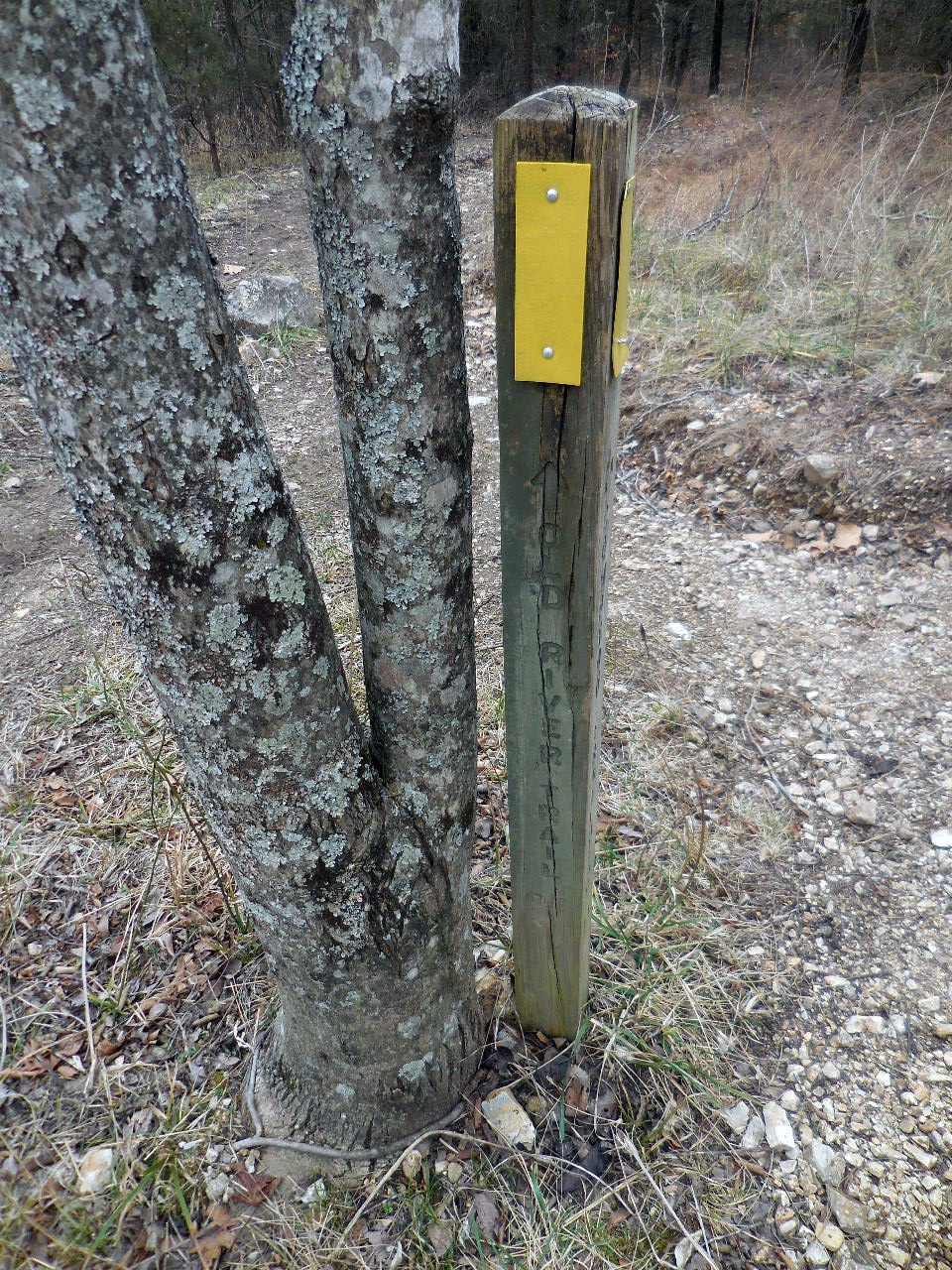
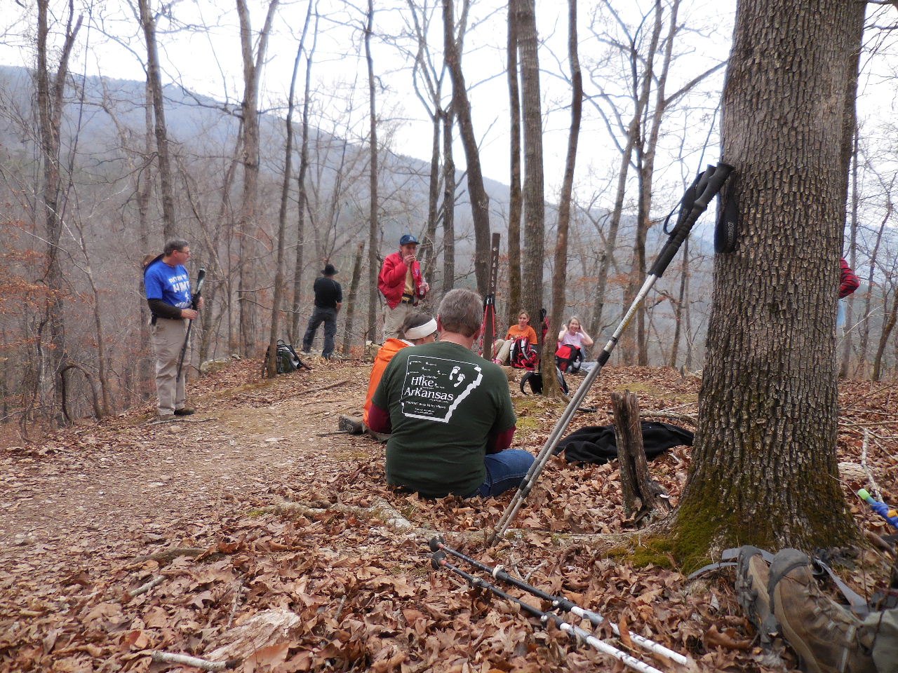
Trailhead Sign
.jpg)
"A" Microwave Tower

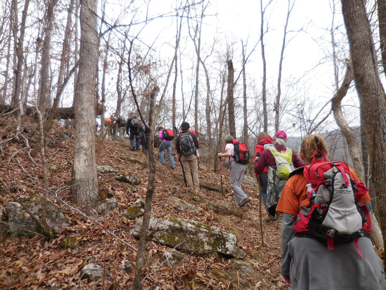
Beginning of Centerpoint Trail
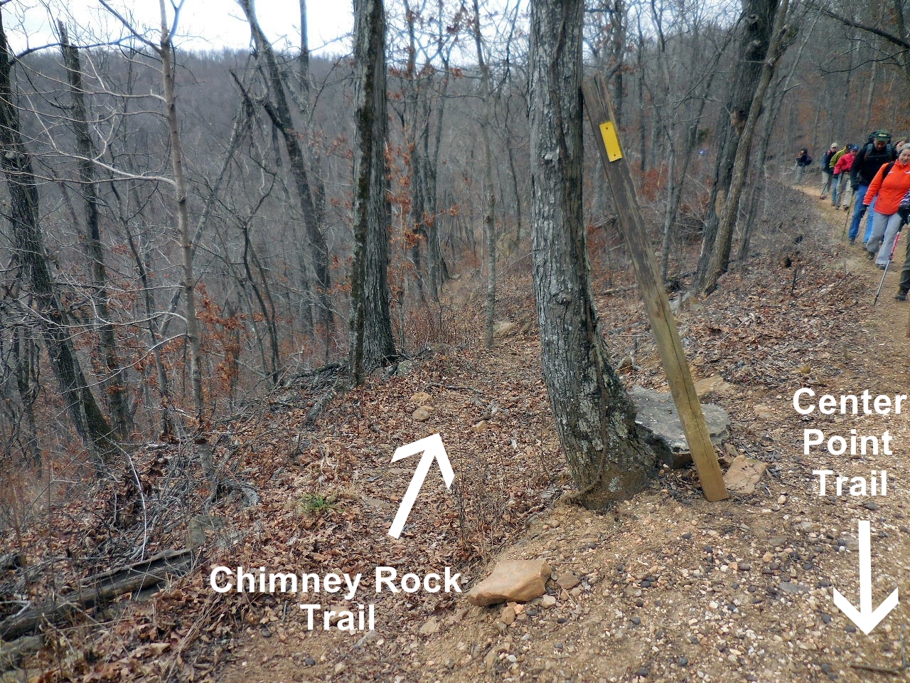
Access Point "1" Chimney Rock Trail
36.06527°, 93.35763°
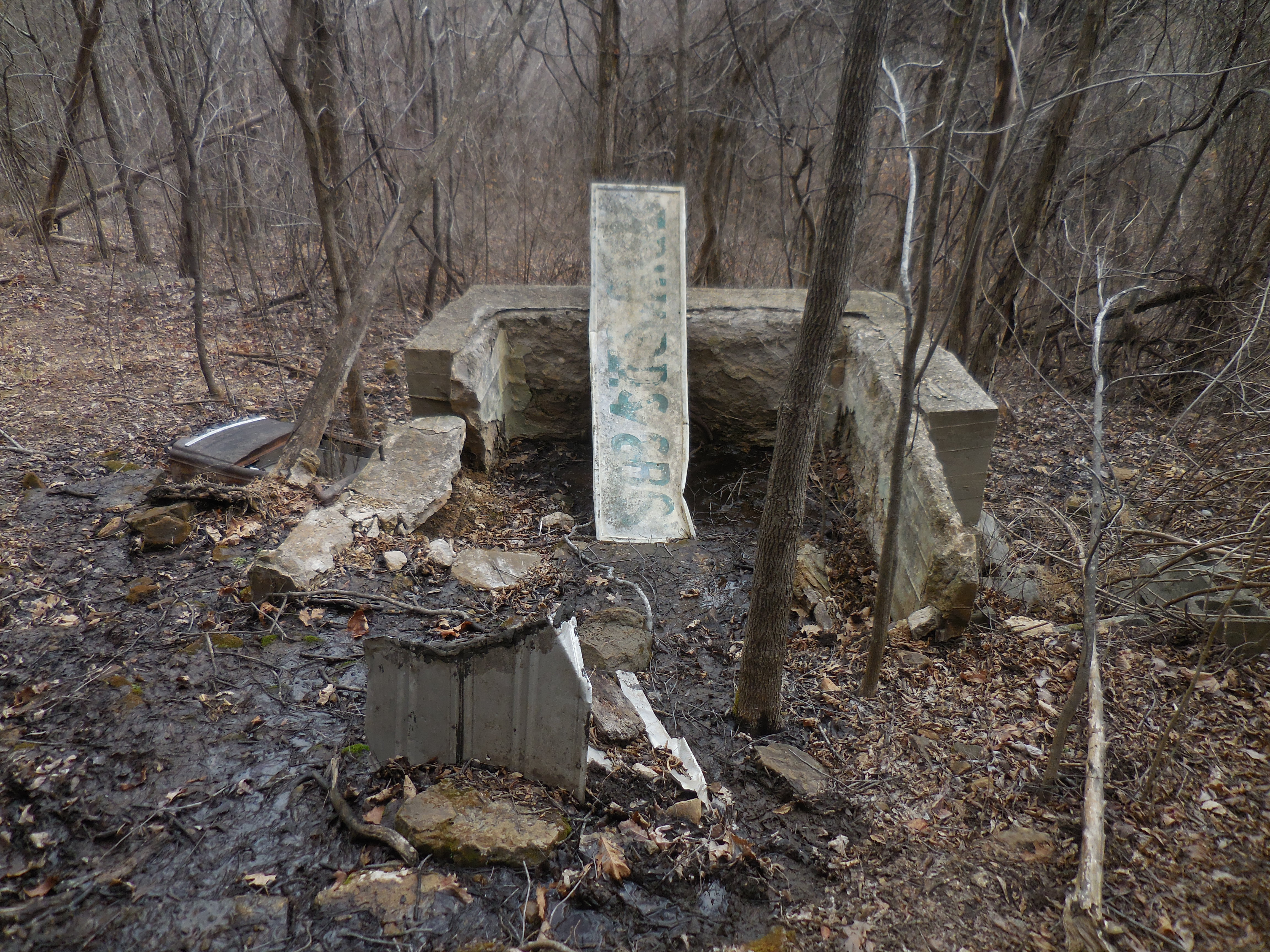
Reservoir

Celler
"A" William Parker Homesite
(aka Parker Hill)
Just uphill is a concrete reservoir near a spring
36.06575°, 93.34173°
Access Point "2"
36.06493°, 93.34005°
(Horse Trail down to Sneeds Creek)
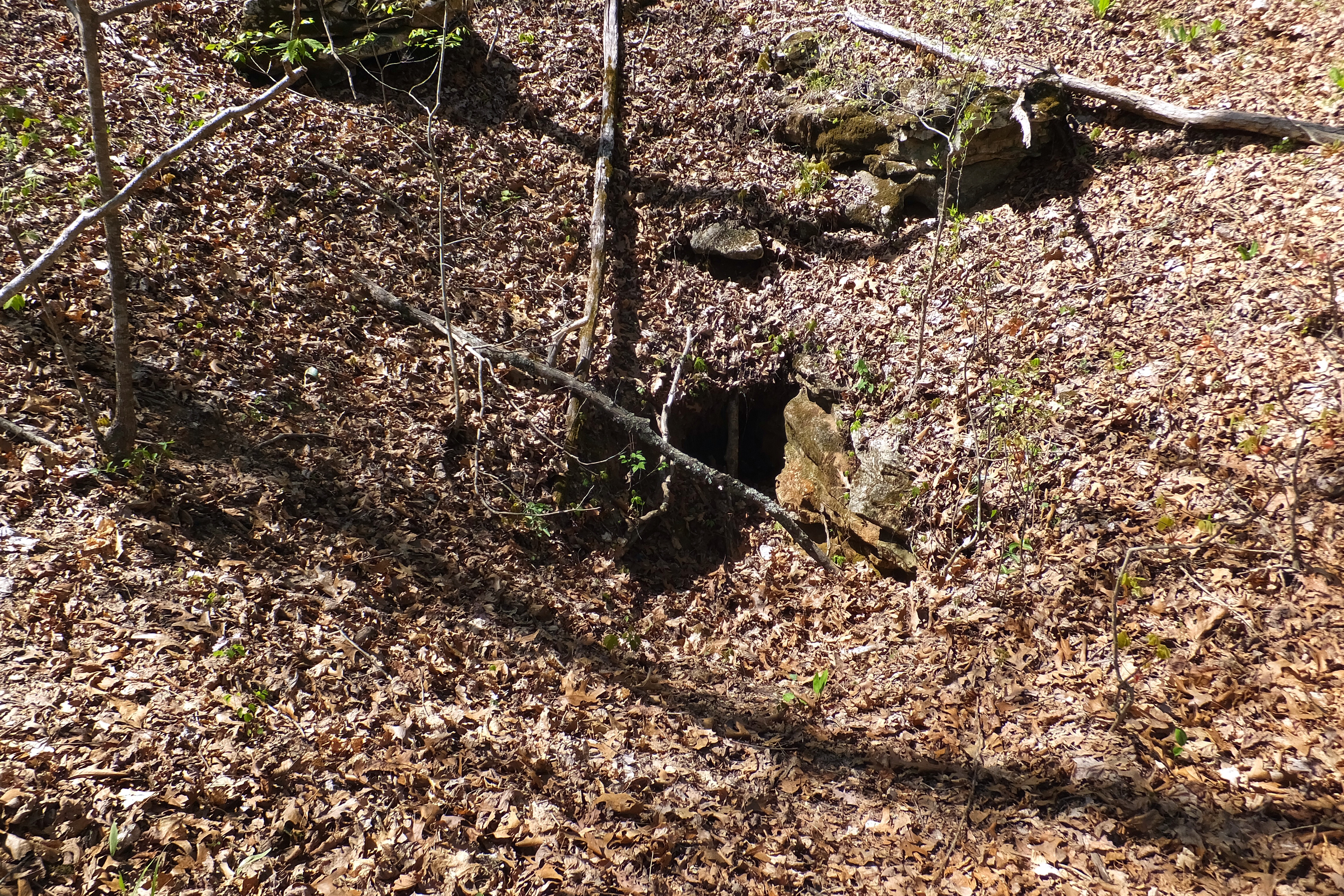
"C" Sinkhole 36.05492°, 93.32688°
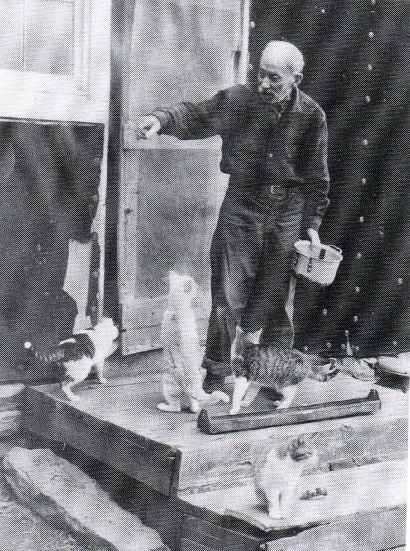
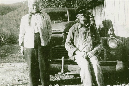
"B" 1/2 mile down the road from Parker Hill is the
homesite of Frank Marshall Little (aka Cat Man).
36.06091°, 93.33527°
He always kept 15-30 cats.
He was married to Revia Mae Moore (1896-1974)
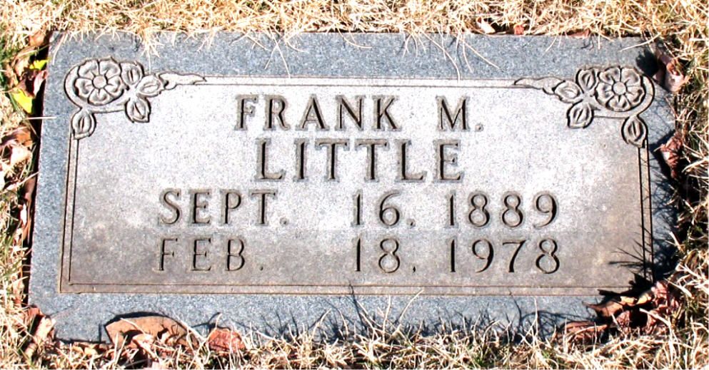
Frank is buried in Plumlee Cem., Compton, AR

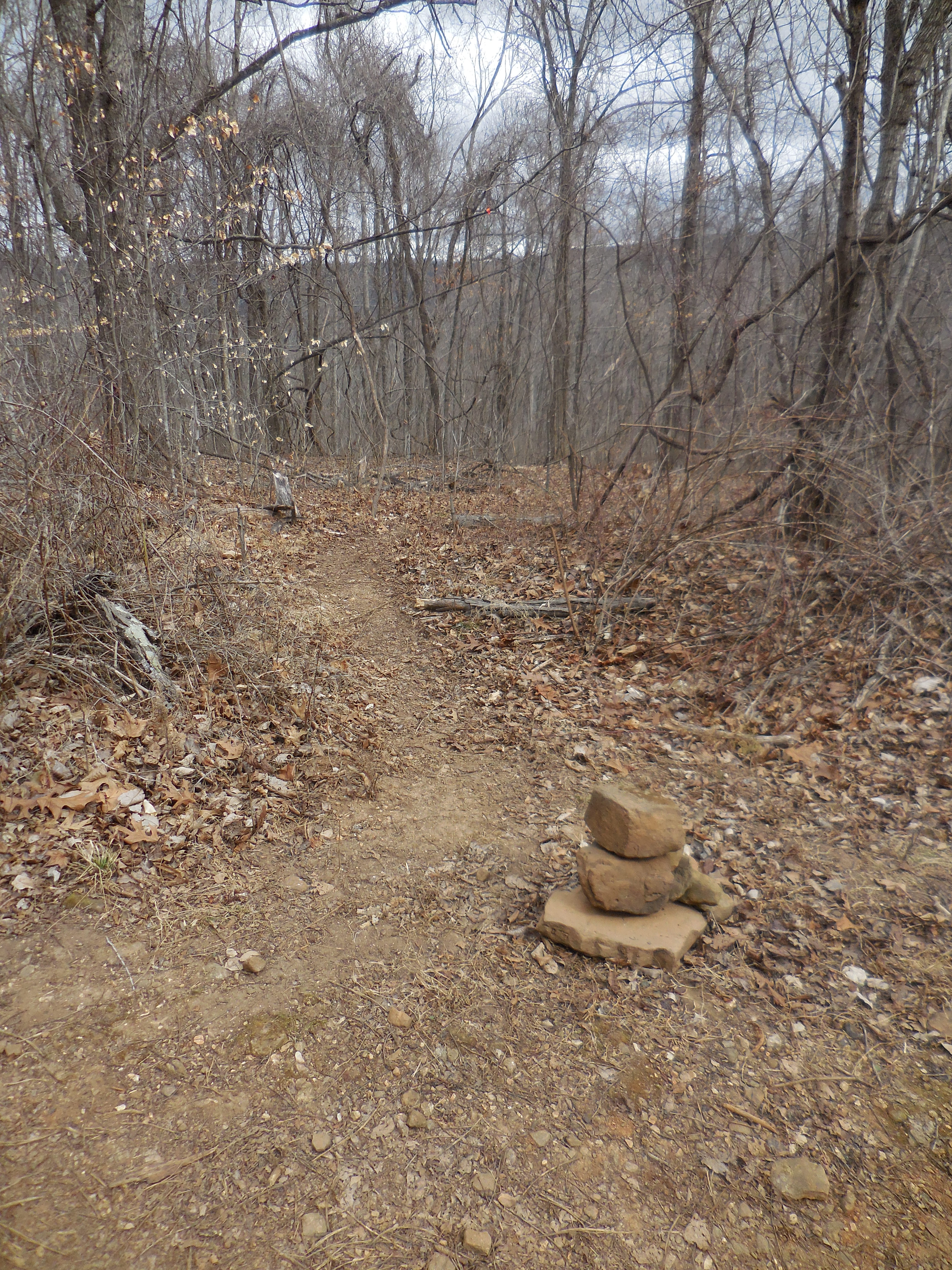
Access Point "3" Goat Trail Intersection
36.05456°, 93.32352°
On the left side of this intersection is a
36" Chinkapin Oak and also in this area is
a sinkhole 10' deep and 30' across.

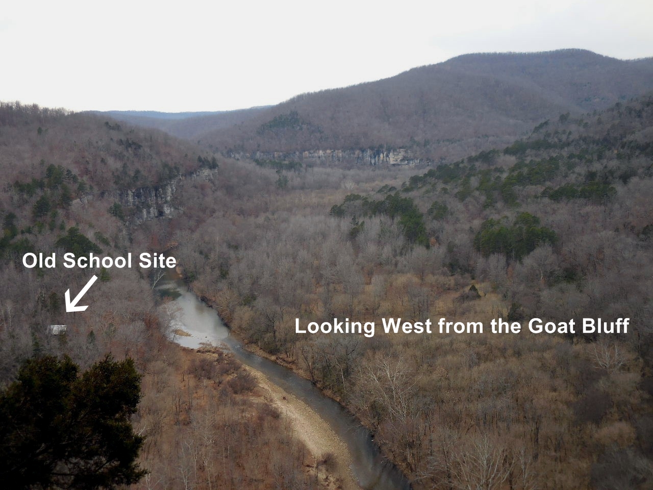
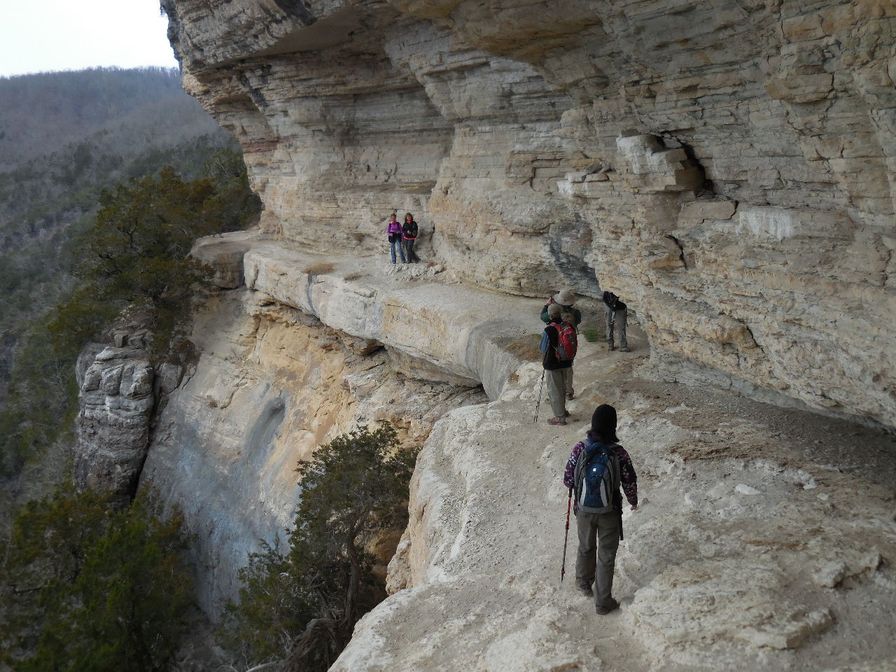
Trail heading south to the Goat Bluff
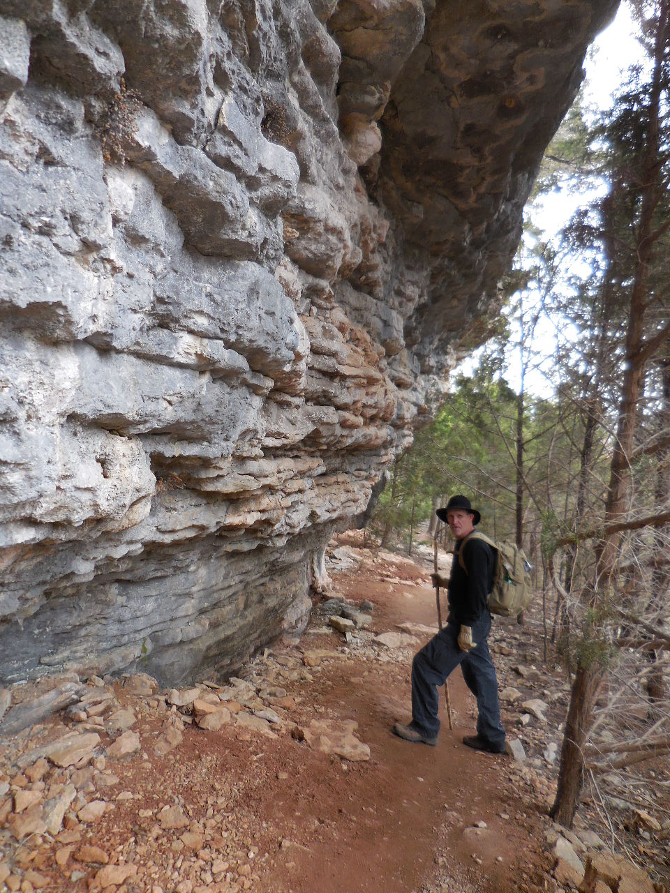
First bluff encounter
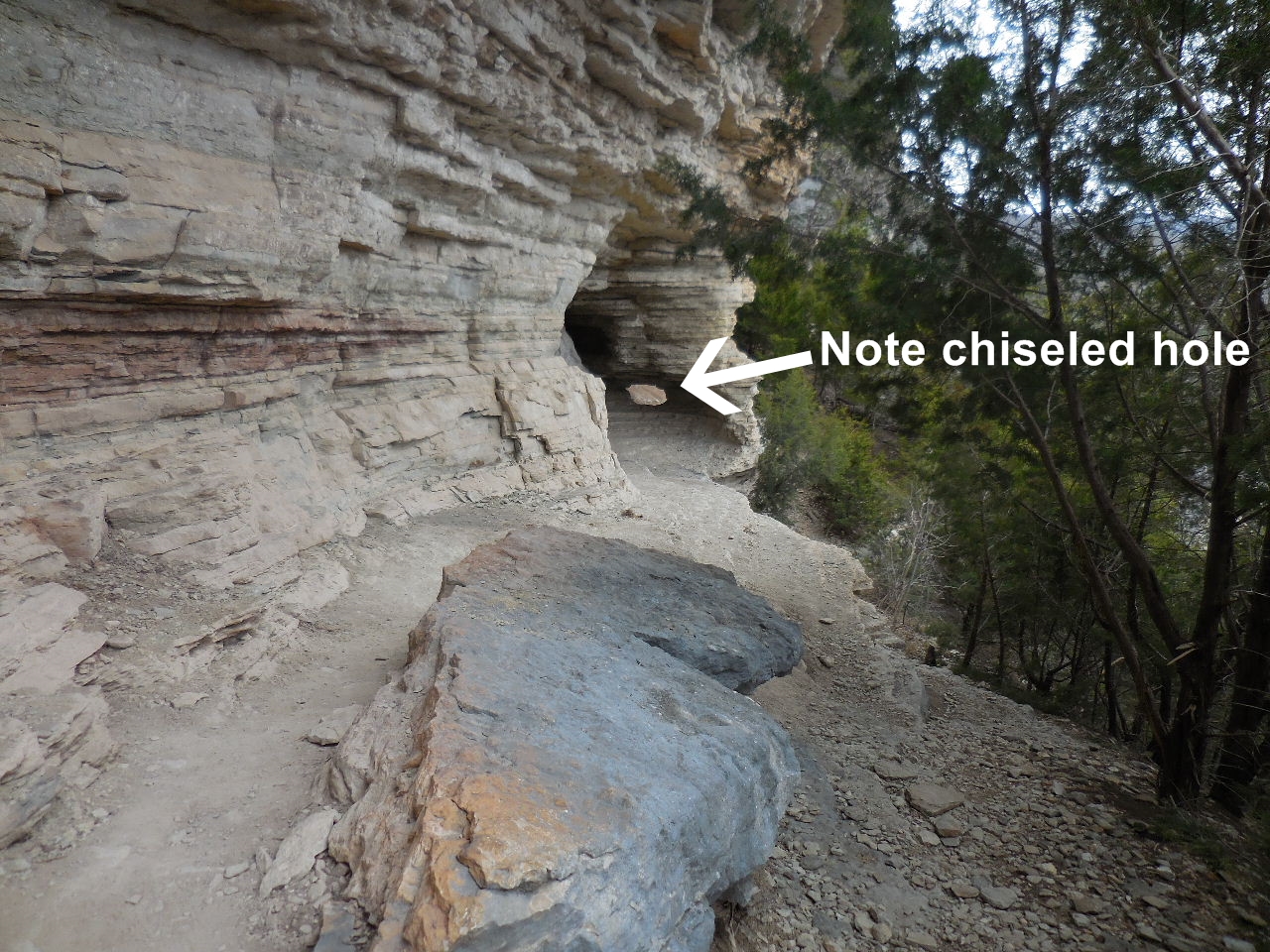
The chiseled hole was made by parents of school
children (a.1910) to make it safer for them to walk
along the bluff from the old location of Center
Point School, which is located down below the
Goat Bluff on the Buffalo River.
.jpg)
Site of Old Center Point School (a.1877)
and approximate route of the
school children. The log schoolhouse
burned around 1920. A new schoolhouse was built
near Sneeds Creek (Feature "J")
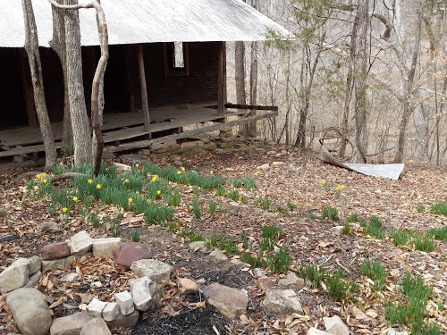
This is the structure you can see from the Goat
Bluff where the old school site was located.
This site was first settled in 1830 by Abraham
Villines. "E" 36.04890°, 93.32357°
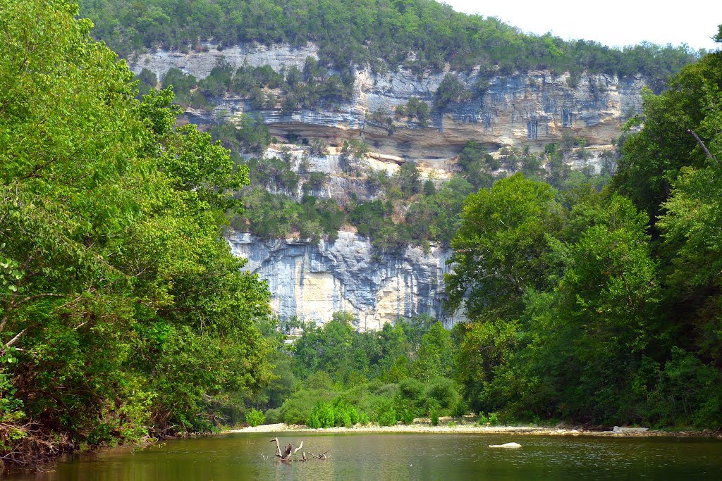
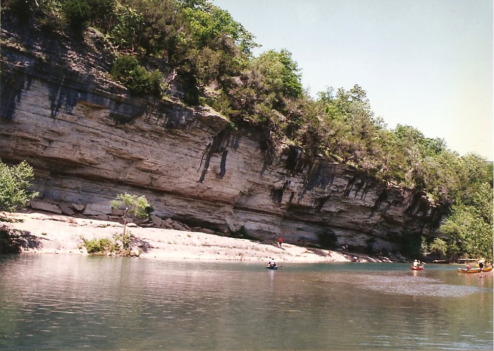
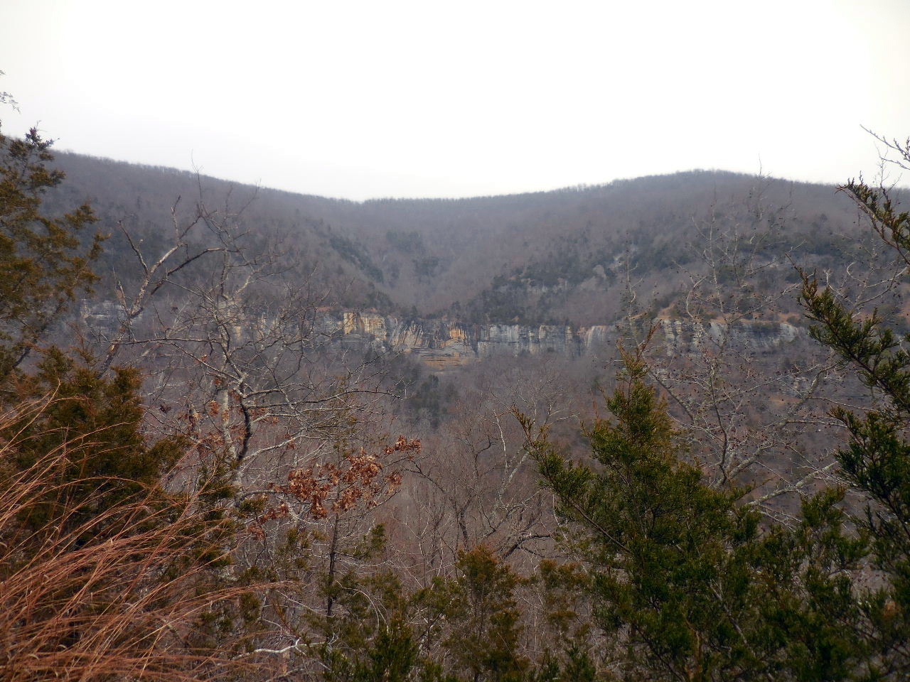
View of the Goat Bluff from the Buffalo River
just north of old school site.
"D" Narrow part of the Goat Bluff
36.05098°, 93.32076°
Access Point "4"
Intersection of Center Point Trail and
Sneeds Creek Trail 36.05637°, 93.31345°
(Entrance to Granny Henderson's Cabin)
Heading north to Granny's along
Sneeds Creek Trail
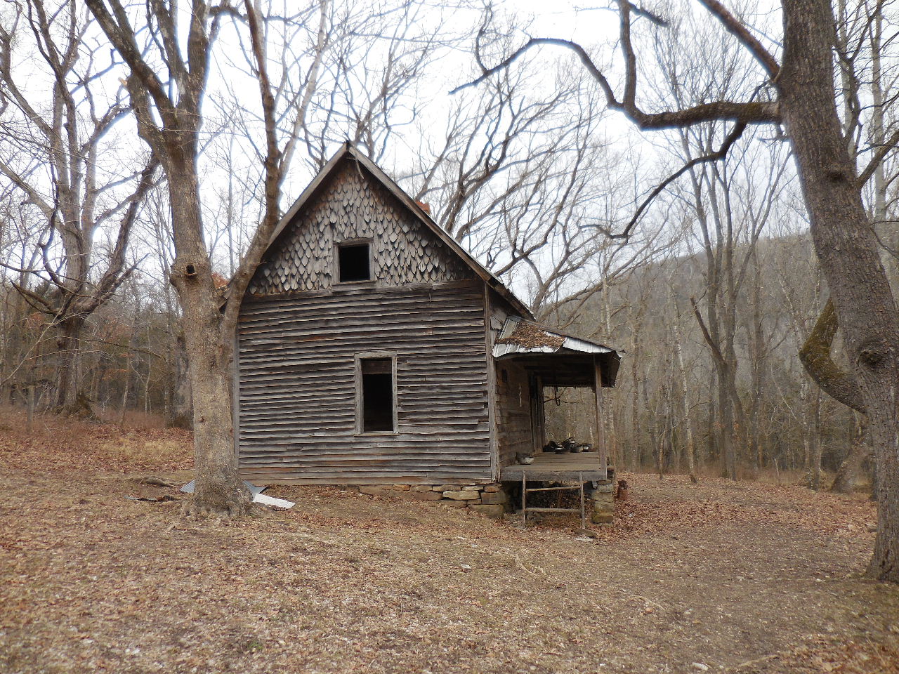
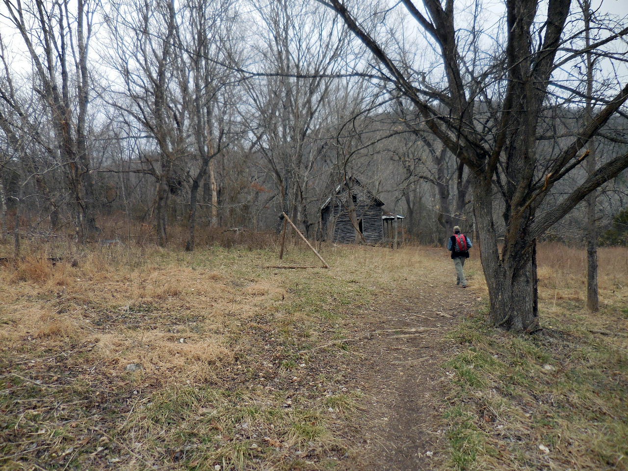
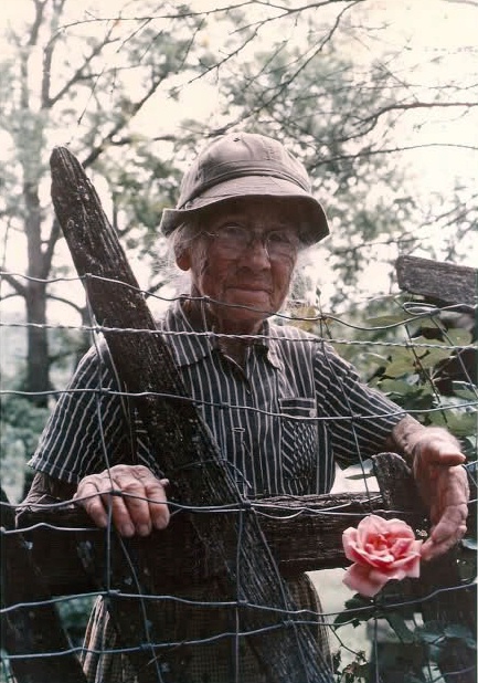
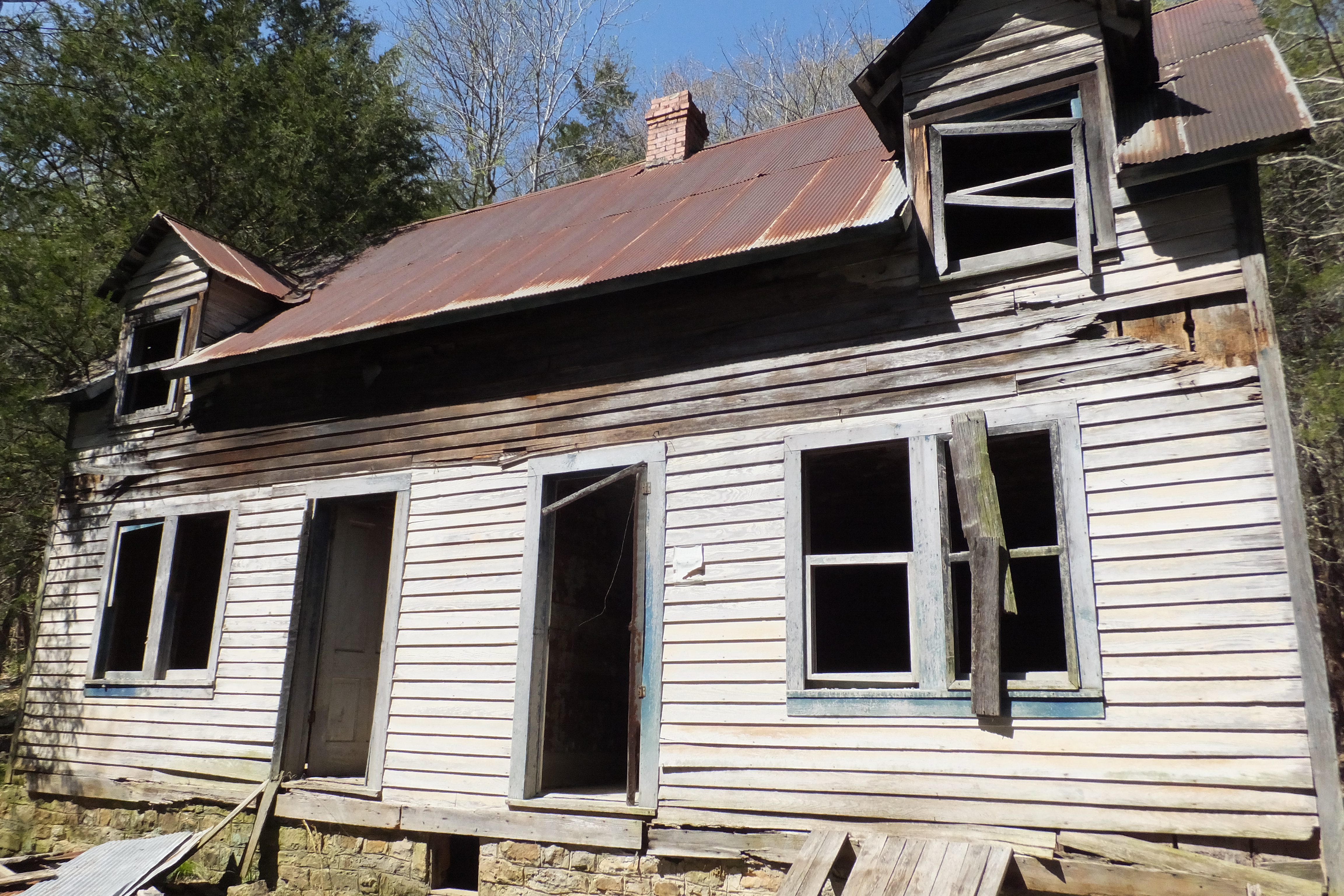
"F" Granny Henderson's Cabin
(See more pictures and story below)
36.05710°, 93.31341°
Story and Pictures of Barbara Eva Barnes Henderson & Family aka "Granny Henderson"
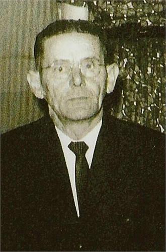
Howard Villines
Howard Villines related the following account of his recently deceased and beloved grandmother. His grandmother was Eva Barnes Henderson, or "Granny" Henderson to all who knew her, one of the most legendary and beloved residents of the Ozarks.
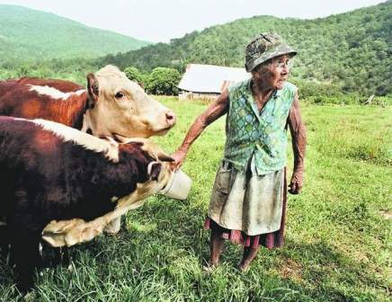
Granny Henderson was born near the Buffalo River and had lived continuously on her 166 acres near Compton since 1912. She spent the last 23 years of her time on the land alone after her husband had passed away. She lived without the comforts of electricity, telephone, and plumbing, but she loved her home and welcomed countless "floaters" and tourists whom she let camp on her property through the years. Granny Henderson befriended so many people that she corresponded with people from as far away as Canada and England. She was once featured in National Geographic as exemplifying the finest attributes of the Ozark woman.
About 1976 two or three Land Acquisition Officers from the Park Service approached Granny Henderson on her land and said, "We've come to appraise your place." Villines said his grandmother replied, "Appraise my place! What for? I wouldn't sell it for anything." To which the Park Service replied, "You'll sell it or we'll condemn it and take it." This shocking statement made the elderly woman physically ill and she was bedridden for several days after initial contact with the NPS. At first, the Harrison office of the BNR denied such rude treatment of Granny Henderson, but they did send someone out to apologize.
Although there is some dispute on this matter, the Park Service may have failed to realize that Granny Henderson was not even the sole owner of her land. Her husband's will left her grandson, Howard, as co-owner. Howard Villines to this day remains bitter that the NPS probably did not even check the available records to determine correct ownership. He feels that his grandmother should not have been approached first by the LAO personnel. After the initial contact, he insisted that the Park Service deal directly with him and cease harassing his grandmother, a request with which the NPS complied.
Then began what Villines called three or four years of "badgering" by the Park Service for him to sell the property. Time and again the Harrison NPS office would call Howard Villines to say that they had raised their purchase offer. After twice driving his grandmother on the tortuous road from her farmhouse all the way to Harrison only to discover that the LAO had not changed perceptibly its previous offer, Villines began to realize that the Park Service would probably eventually resort to condemnation. Therefore he asked for what he considered was a fair price and after an 18 month wait, the NPS agreed. In the subsequent negotiations the Park Service offered Granny Henderson a life estate on the land, but forbade her from keeping her few livestock (although the NPS has denied that it told her this). Her livestock were very important to her according to Howard Villines. She wanted her cattle where she could watch them and carry water to them daily. Granny Henderson was very distressed by this latest stipulation dictated by the Park Service. The thought of leaving her home of 65 years was too much for her to think about. As she had told National Geographic, "I hope to stay just as long as the Lord and those Government folks allow. Moving out o' here would mean givin' up all I've got, all I've ever had." Sadly, Granny Henderson decided that if she could not have her treasured livestock she would just as soon move.
After the sale was consummated, Howard began to build a new house for his grandmother near his own. It was wintertime, however, and he asked the Park Service if they would allow his grandmother to remain on her land longer than the three months stipulated in the sale contract. The agency agreed, but only if Eva Barnes Henderson paid rent on the land she had lived so long upon. After Howard told his grandmother this latest development, "she just sat by the stove and wrung her hands. Time after time, I went down there and she would be doing that."
When the day of the move came, late February of 1979, Howard Villines recalled, "We wanted her to come out to the new house with the first load, but she said, 'Just let me stay till the last load,' so that's what we did. She sat on a stool by the stove and cried the whole day." Granny Henderson spent only two days in the new house. She was then hospitalized for tests for cancer. She had borne "a small red pimple" on her forehead for 40 years, but at this stage of her life it had begun to grow into a malignant tumor. After Granny Henderson left the hospital she stayed at her grandson's home that night. The following morning revealed a heavy night's snowfall and Granny Henderson said, "Oh goody, its-a snowing. Now we won't have to go to that house." Granny Henderson always referred to her new house as "that house." Howard Villines then asked his grandmother to stay in his home. Five months later, Granny Henderson died, never having returned to "that house" forced upon her by the Park Service.
The doctors who diagnosed her cancer said that a "trauma" had sparked the new growth. Howard Villines said, "We feel it was definitely the trauma and stress of the three years of dealing with the Park Service over property she would not willingly have sold at any price and the dread of leaving what had been her home for 67 years."
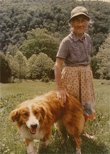
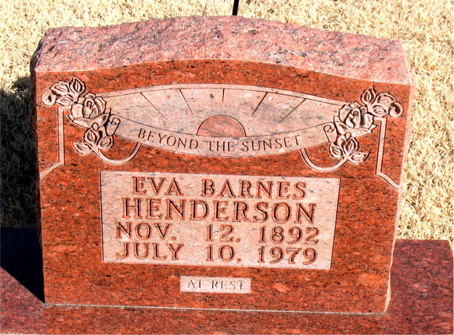
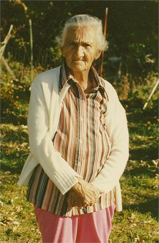
Eva and Bobby
Eva was born on Nov. 12, 1892 in
Newton County, Arkansas.
Her full name was Barbara Eva Barnes
Eva and some of her pigs
Granny Henderson's Cabin
(as most folks know it)
Click Here for Ozarks Alive Story
.jpg)
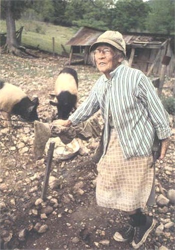
Eva at the Buffalo River getting
water for her livestock, which
included cows, pigs and chickens.
Eve's parents were:
Jonathan Barnes (2/11/53-1/31/94) and
Iris Susan Buchanan (8/14/60-1/9/45)
Eva and Bobby in her chicken coop
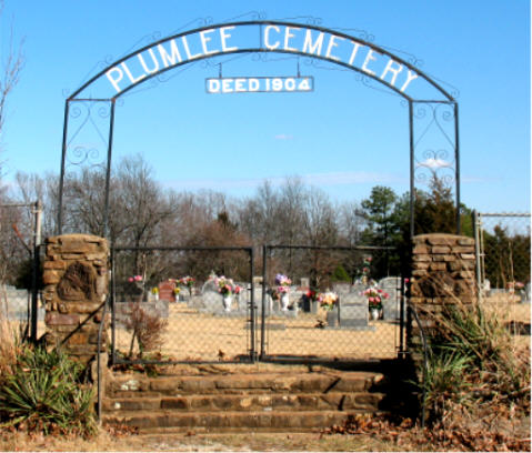
Plumlee Cemetery
Compton, Arkansas

Eva's Funeral Card
Barbara Eva Barnes Henderson
Plumlee Cemetery
Compton, Arkansas
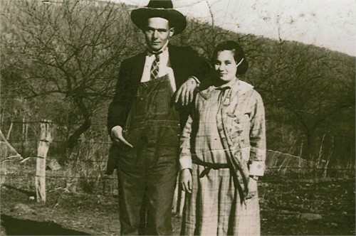
Eva and Frank Henderson
Eva and Franklin Monroe Henderson
were married on Aug. 16, 1908 in
Newton County, Arkansas.
They had only one child: Arbie
She was born on Oct. 7, 1910.
.jpg)
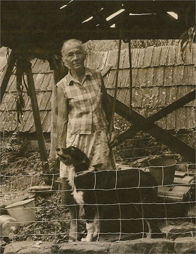
Eva and her dog Bobby
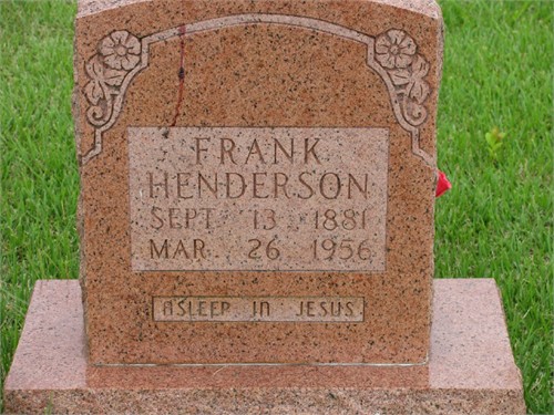
Frank Henderson
Mount Sherman Cemetery
Mount Sherman, Arkansas
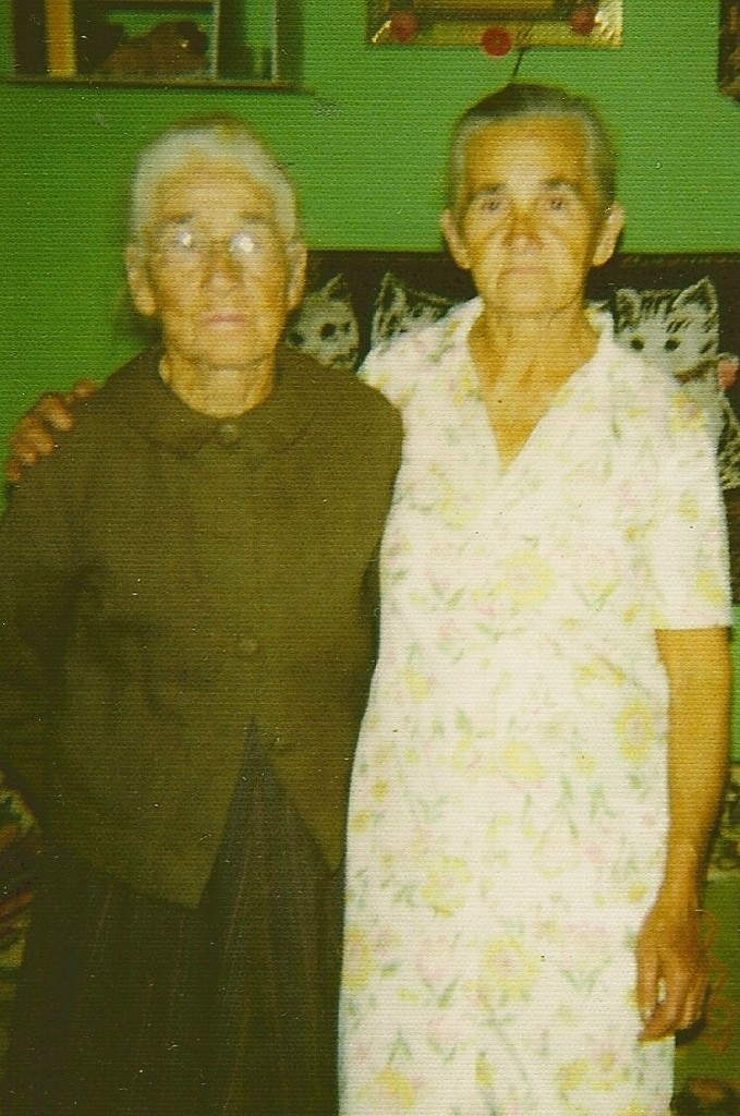
Eva and Arbie
Eva and Arbie
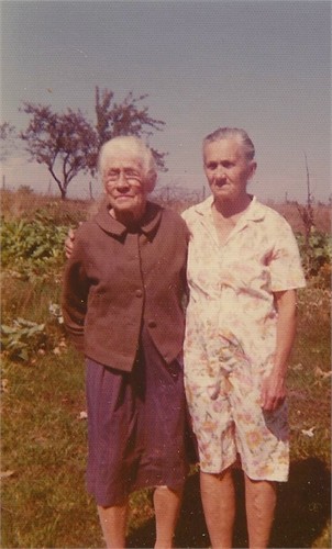
Eva and Arbie
Arbie Henderson Villines
Arbie married Ray Villines on May 7, 1929
in Newton County, Arkansas.
They had nine children.
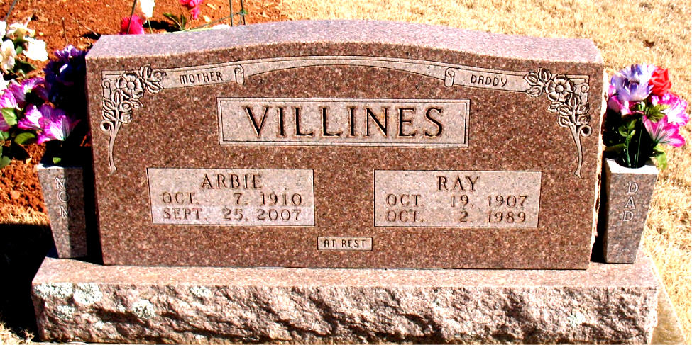
Arbie and Ray Villines
Plumlee Cemetery
Compton, Arkansas
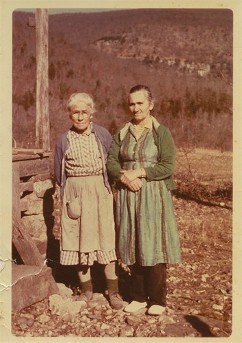
Ray and Arbie
Jessie Raymond Villines
From Granny's head south to the intersection of
the Center Point Trail. (Access Point "4")
At this intersection, head south
along a trail, and in just a short distance you
will see a trail heading off down the bluffline.
Follow this trail down to the river and soon
you will see Jim Bluff.
Looking at Jim Bluff from Old River Trail (ORT)

"G" Jim Bluff
36.05506°, 93.31394°
.JPG)
Sneeds Creek Trail
36.08102°, 93.30317°
Access Point "11"
36.07515°, 93.31289°
.jpg)
Rock Quarry "K"
36.07320°, 93.31769°
WF "f"
36.06665°, 93.33192°

Vintage Autos

"L" Evans-White House
36.05906°, 93.32622°
Evans-White House (a.1919)
Built by George Evans.
Around 1940 the house became the home for
Ray and Arbie Villines
(Arbie was the daughter of Granny Henderson)

Sandstone Shelters "M"
36.05970°, 93.32328°

"N" Rocky Bottom on Sneeds Creek
36.05951°, 93.31944°
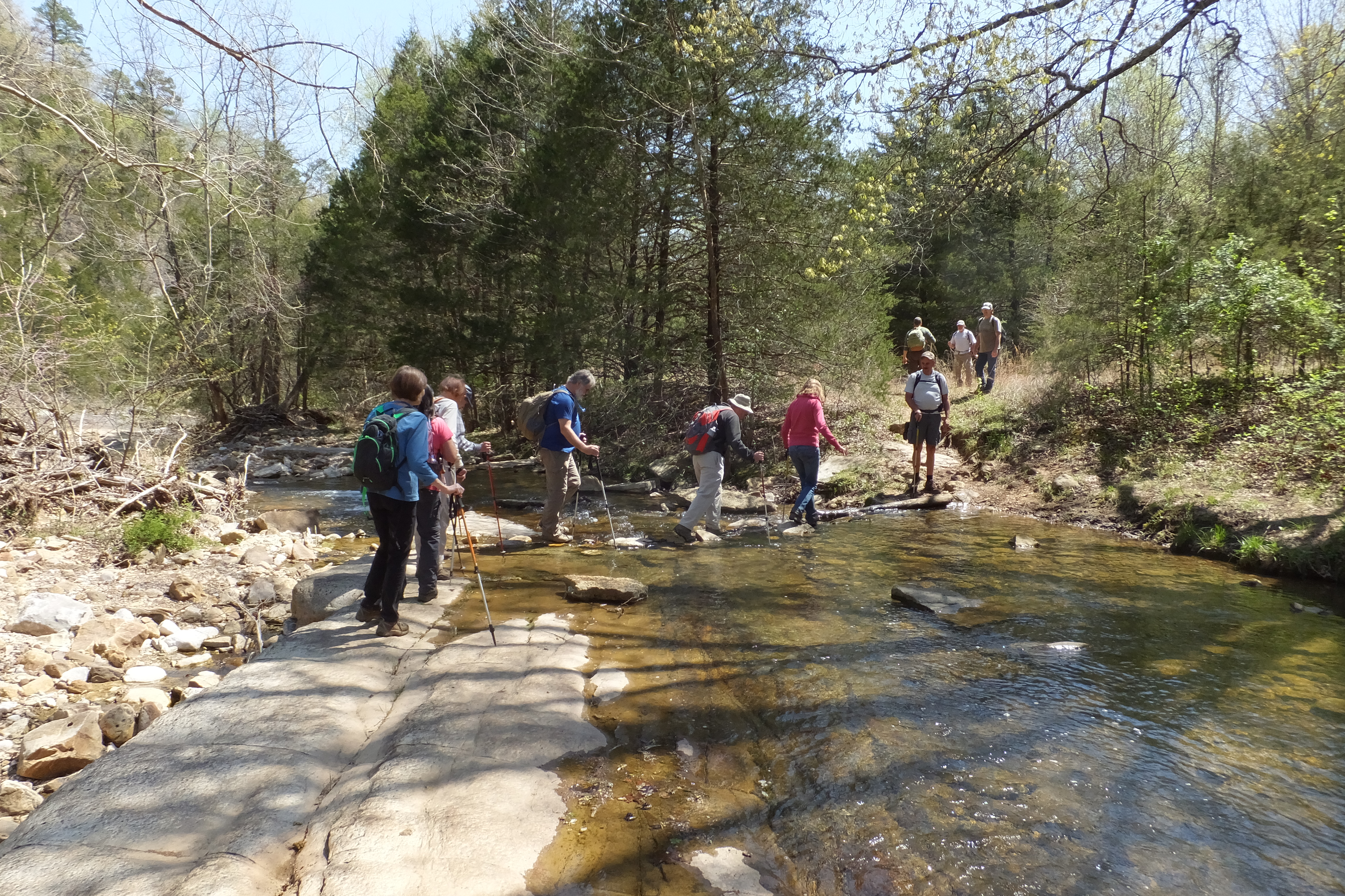
Last crossing on Sneeds Creek
36.05973°, 93.31733°
From Granny Henderson's Cabin there is a
horse trail heading east down to the Buffalo River.
This horse trail intersects the Old River Trail.
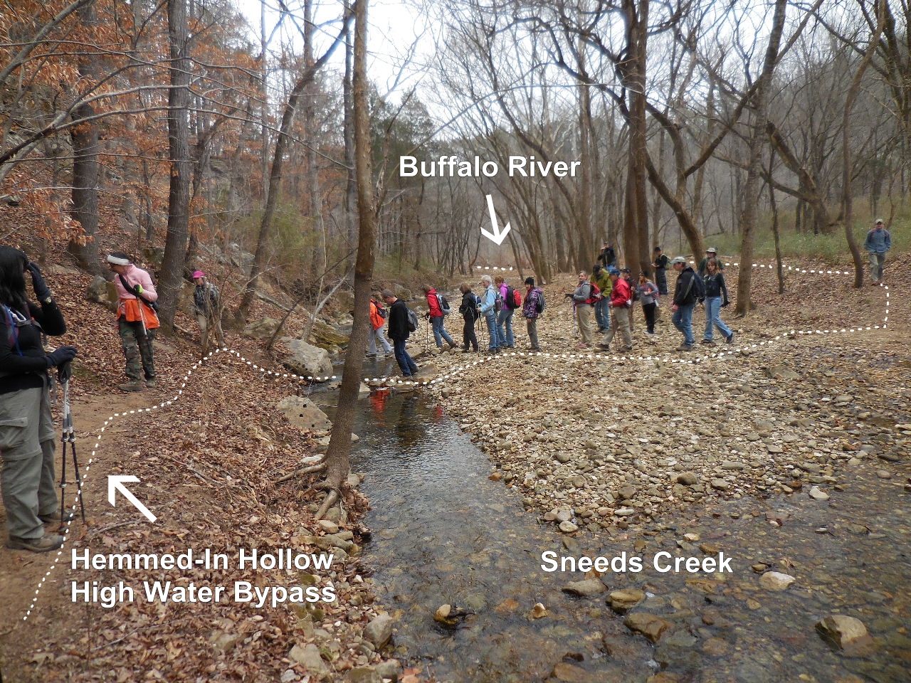
Follow the ORT, along Buffalo River north until
you get to Sneeds Creek. Turn left, west, and
find crossing at Access Point "6" 36.05917°, 93.31016°
and trail on north side of Sneeds Creek which is
the Hemmed-In Hollow high water bypass.
NOTE: The easier way would be to continue
along the ORT, crossing the Buffalo River twice
until you get to Hemmed-In Hollow.
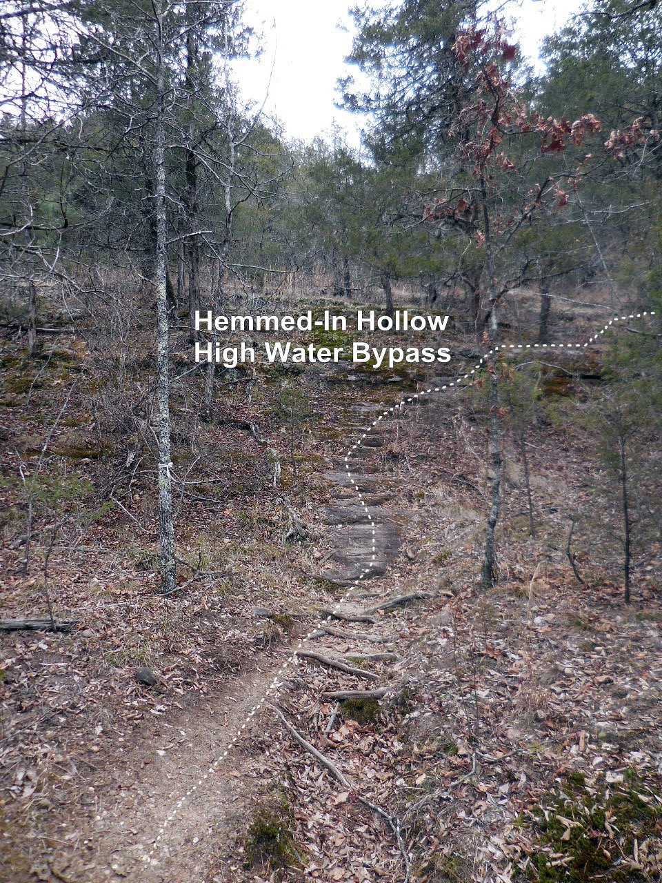
Follow this trail for 0.8 miles to
intersection of Compton Trail and
Hemmed-In Hollow Falls Trail.

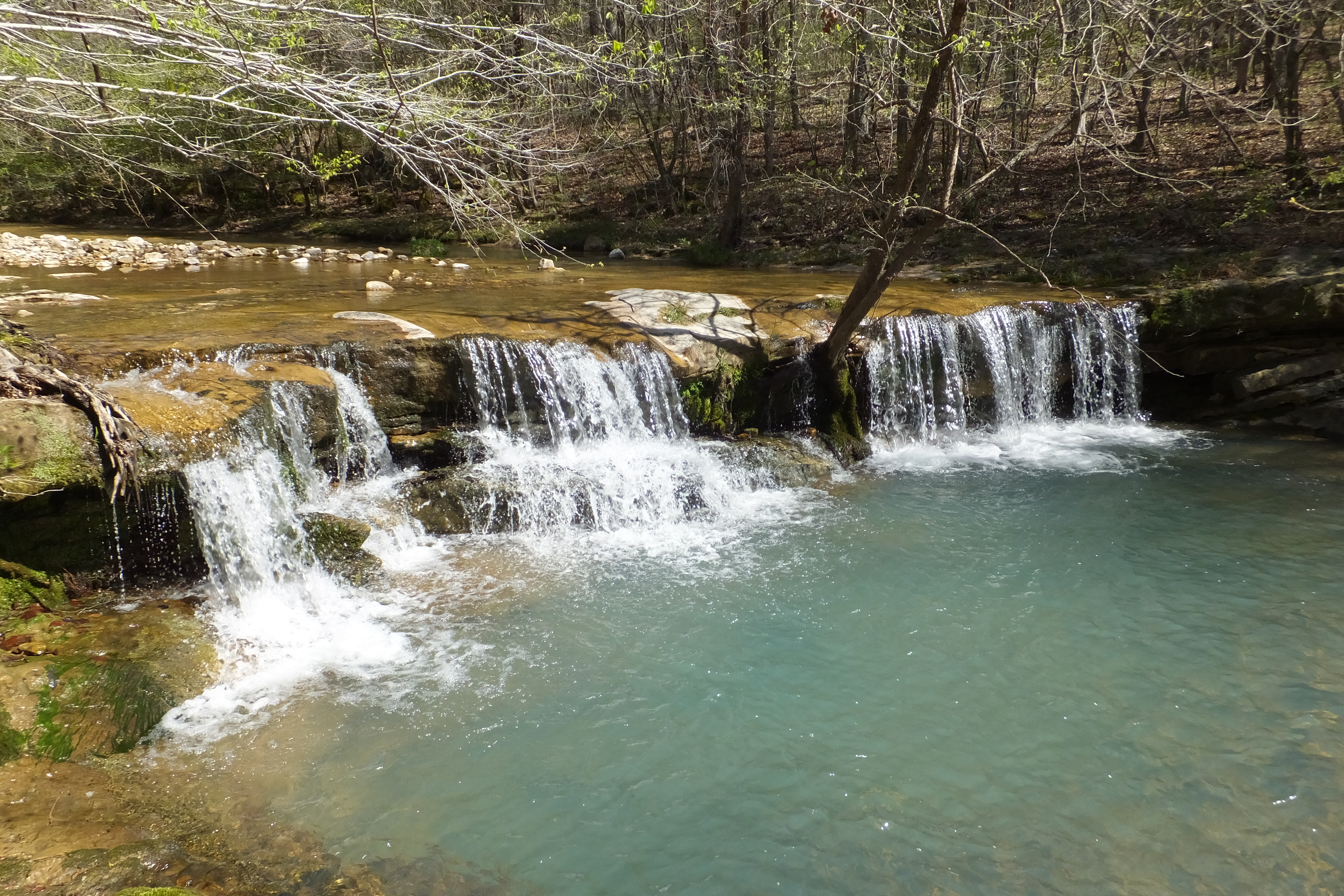
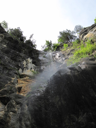
Un-named Waterfall
Intersection Compton Trail and
Hemmed-In Hollow Falls Trail.
Access Point "8" 36.06444°, 93.30925°
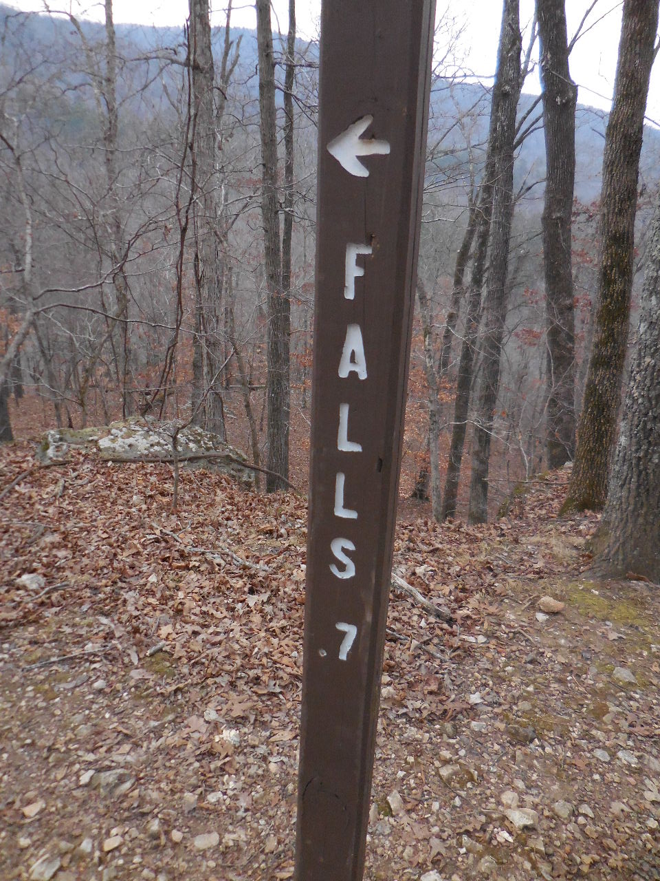
Trail to Hemmed-In Hollow Falls
0.7 miles - one way

Heading down trail to falls

Access Point "9" Intersection
36.06959°, 93.30943°
0.2 miles to Falls - 0.7 miles to Buffalo River

Un-named Waterfall

Un-named Waterfall
(aka Twin Falls below HIH Falls)
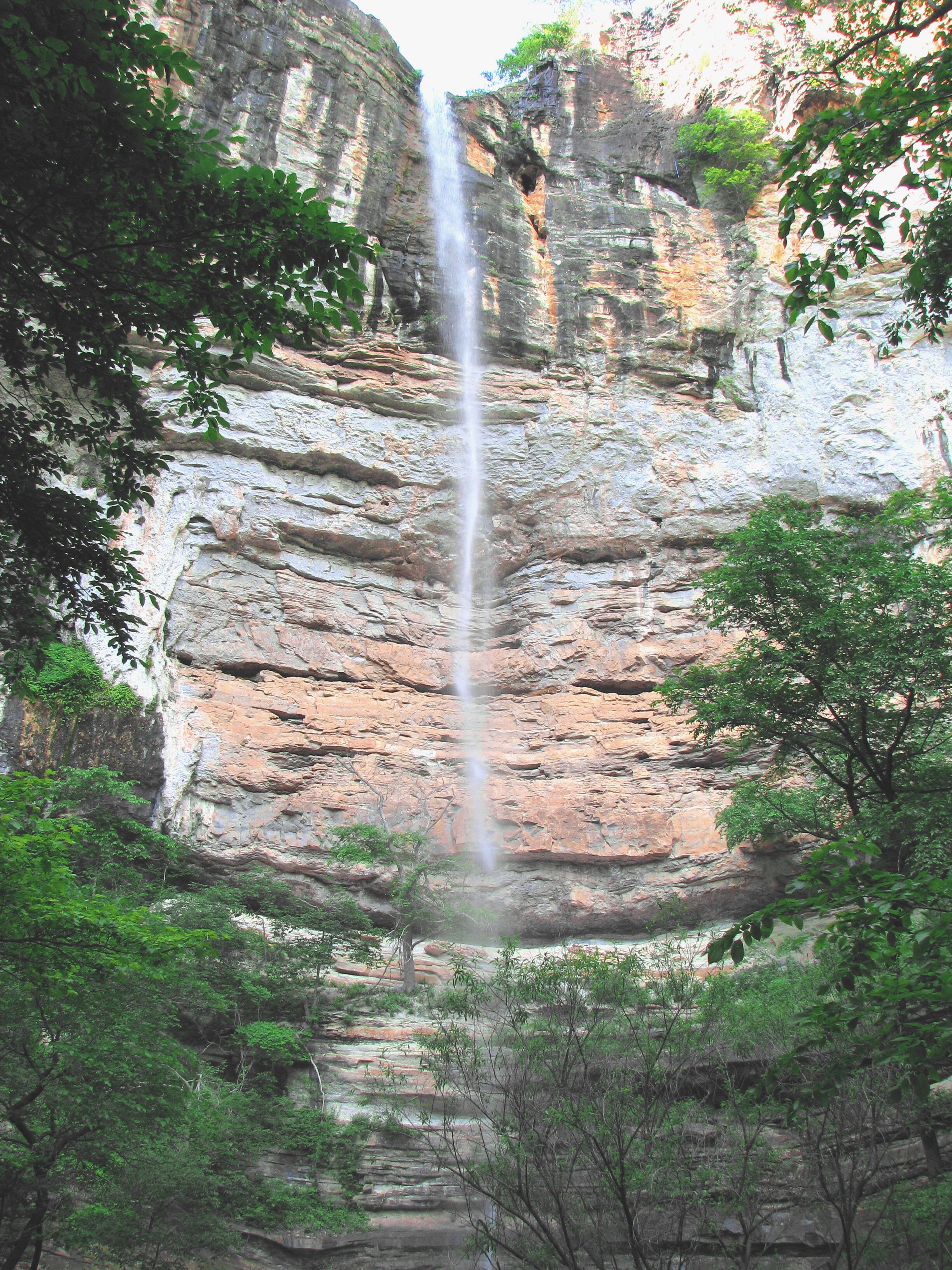
Hemmed-In Hollow Falls (209')
36.07213°, 93.30753°
Diamond Falls (148') from below
36.07167°, 93.30946°
Now back to the intersection of Compton Trail
and Hemmed-In Hollow Falls Trail.
Heading uphill to California Point on the
Compton Trail
View of Hemmed-In Hollow from
"I" California Point
36.06647°, 93.31182°
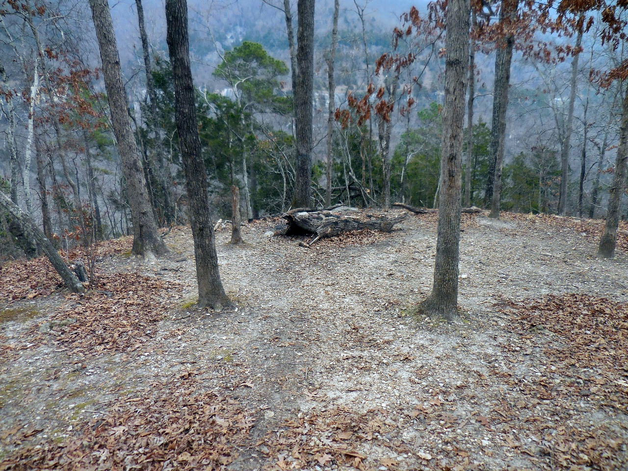
Campsite just uphill from California Point
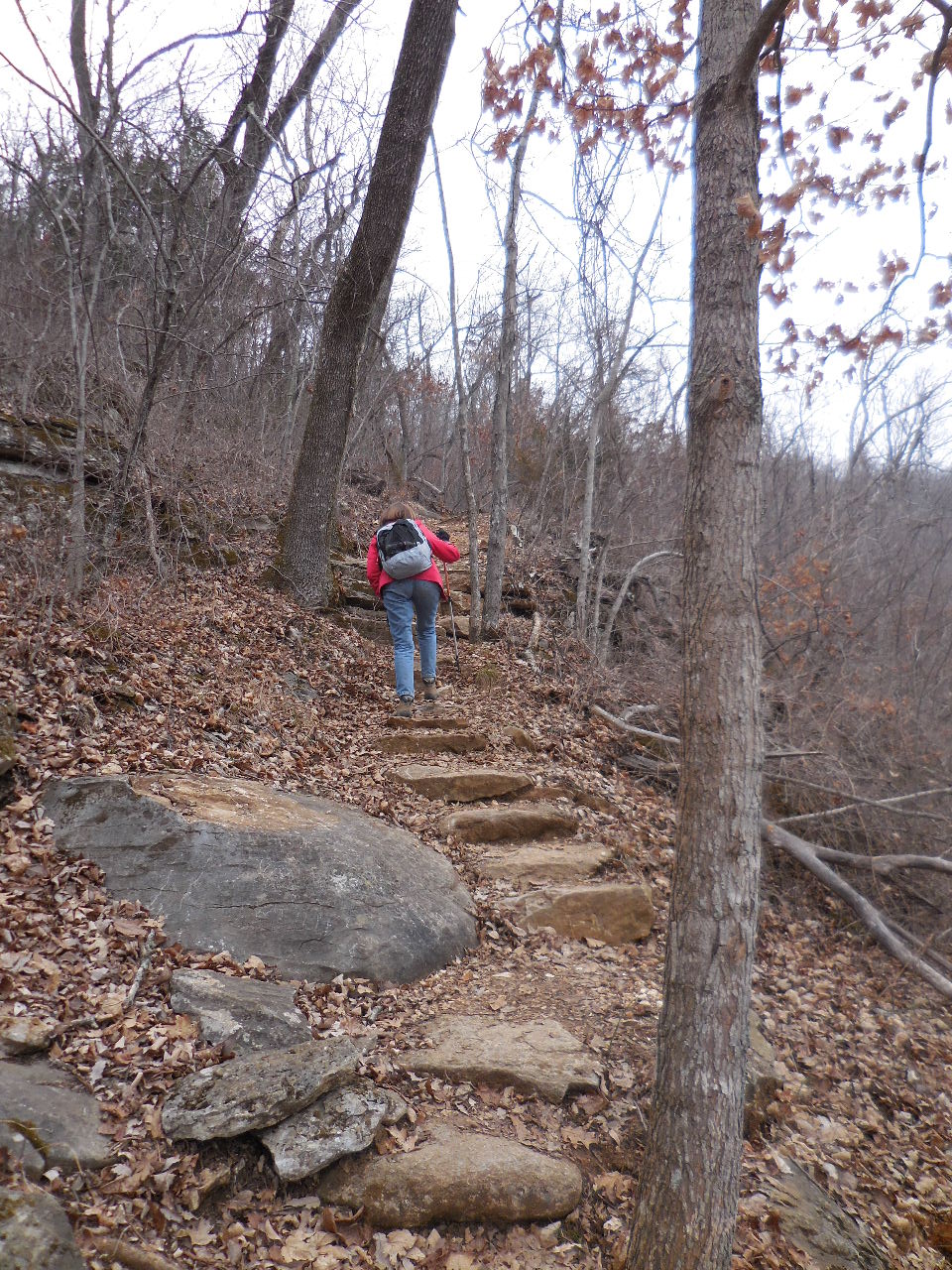
Lots of rock stairs on Compton Trail
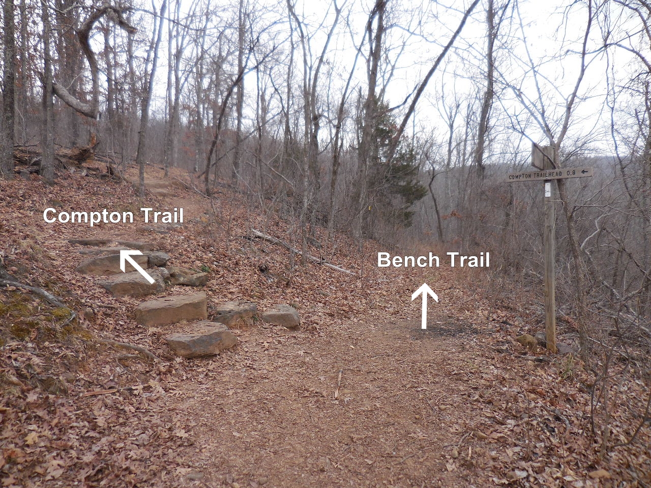
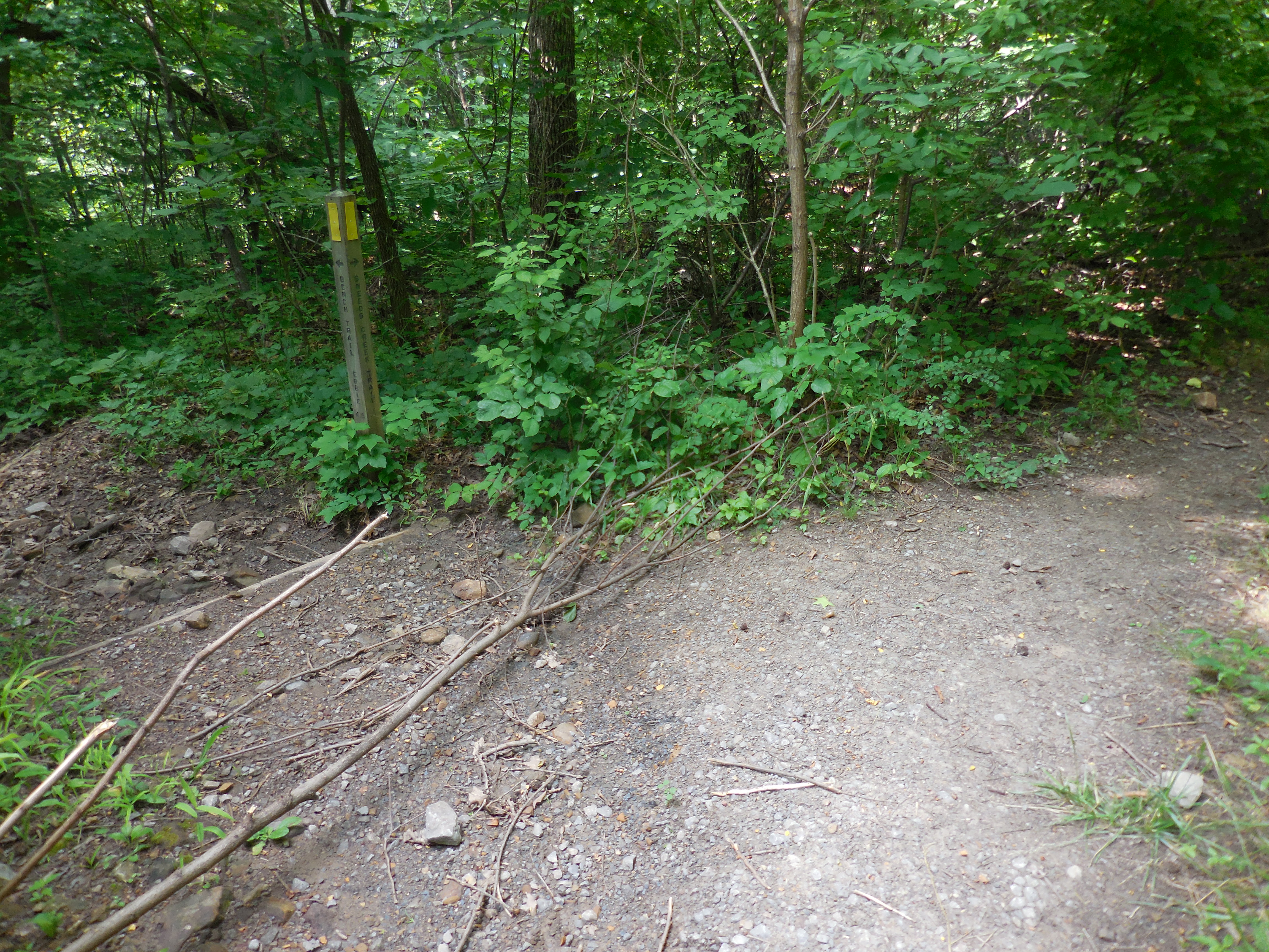
Intersection of Compton and Bench Trail
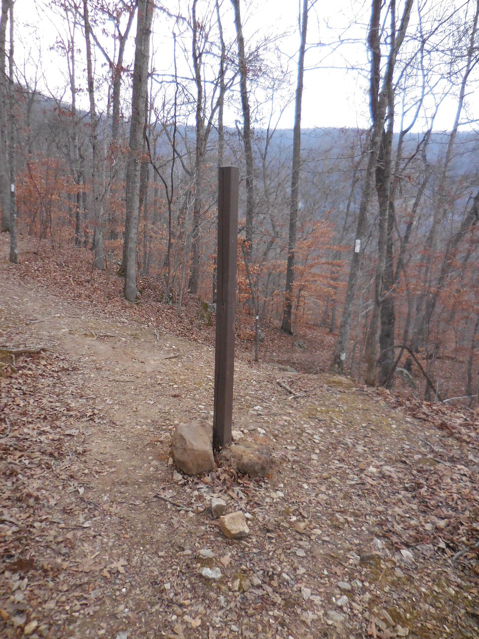
Access Point "7" 36.07436°, 93.31196°
(Compton Trailhead 0.8 miles)
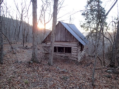
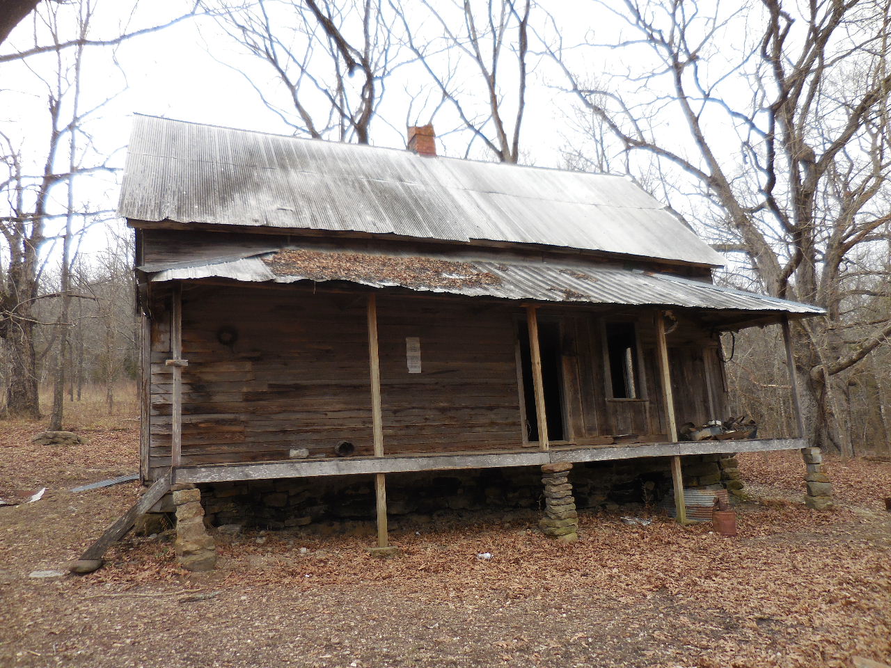
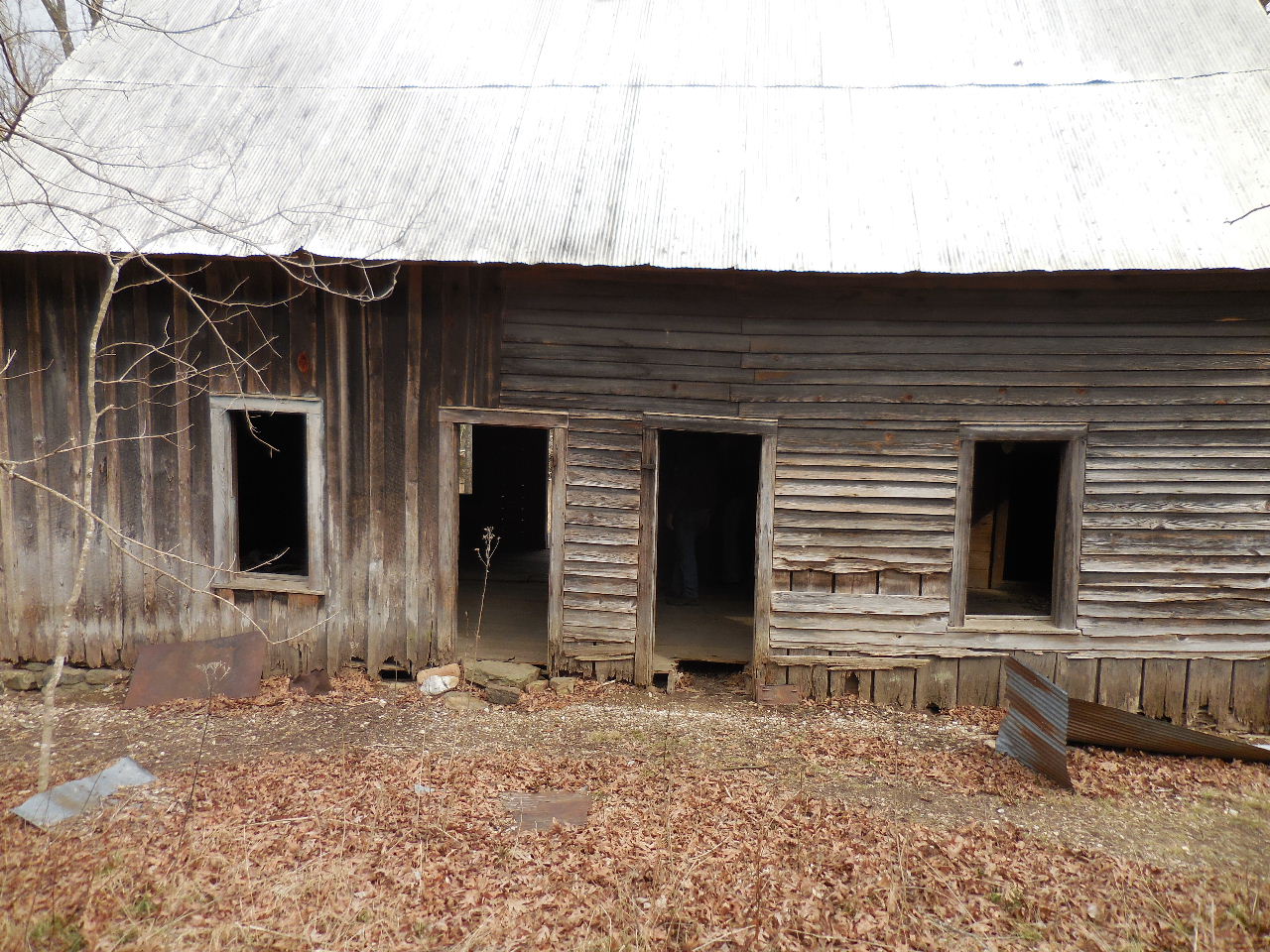
About 800' down the Bench Trail.....
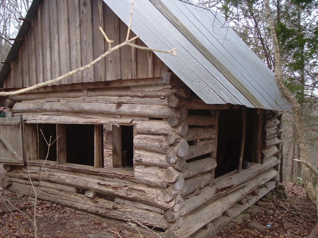
.....you will find Wild Floyd Vic Flowers
"H" Cabin (a.1935)
36.07501°, 93.30945°

View into Hemmed-In Hollow from
the back of Flowers Cabin
(Pic by Patrick Caple)
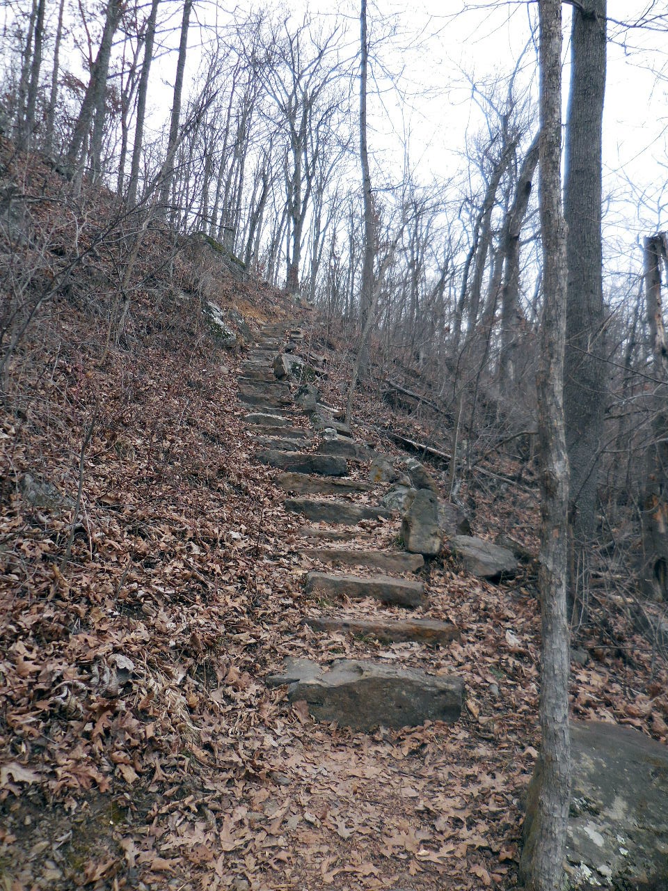
More rock stairs.....
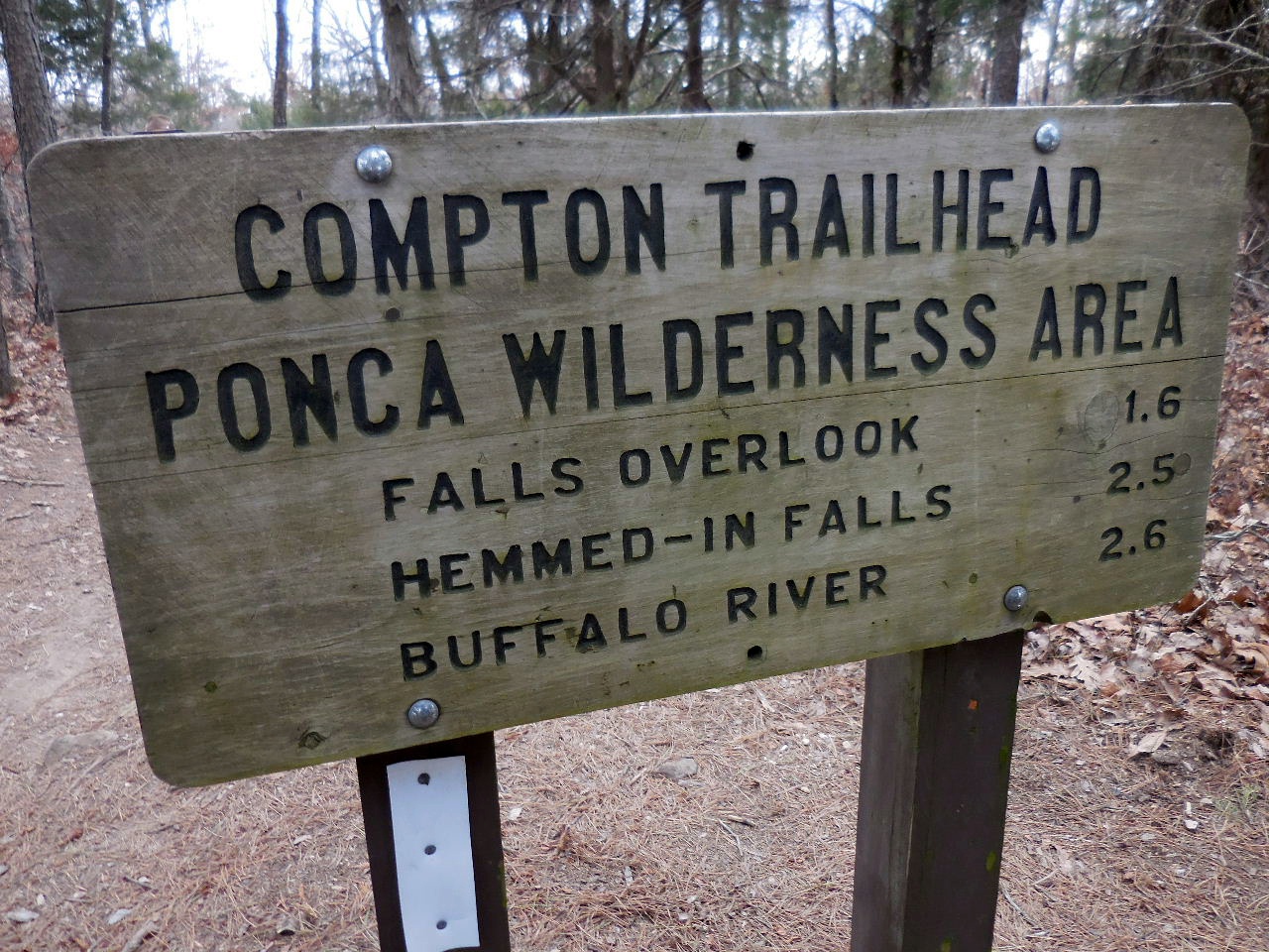

Compton Trailhead and Parking Area
36.08102°, 93.30317°
.jpg)
The goal is to get up there......
Boat Launch Area
Looking west at Steel Creek Campground
Roark Bluff Trailhead "13"
36.03940°, 93.33568°
Boat Launch Area
East end of Steel Creek Campground
Trail Access Point
North side of Buffalo River
36.03940°, 93.33568°
Looking east from Pedestal Point
36.04294°, 93.33979°
Roark Bluff Photo Opt Location
36.04312°, 93.34000°

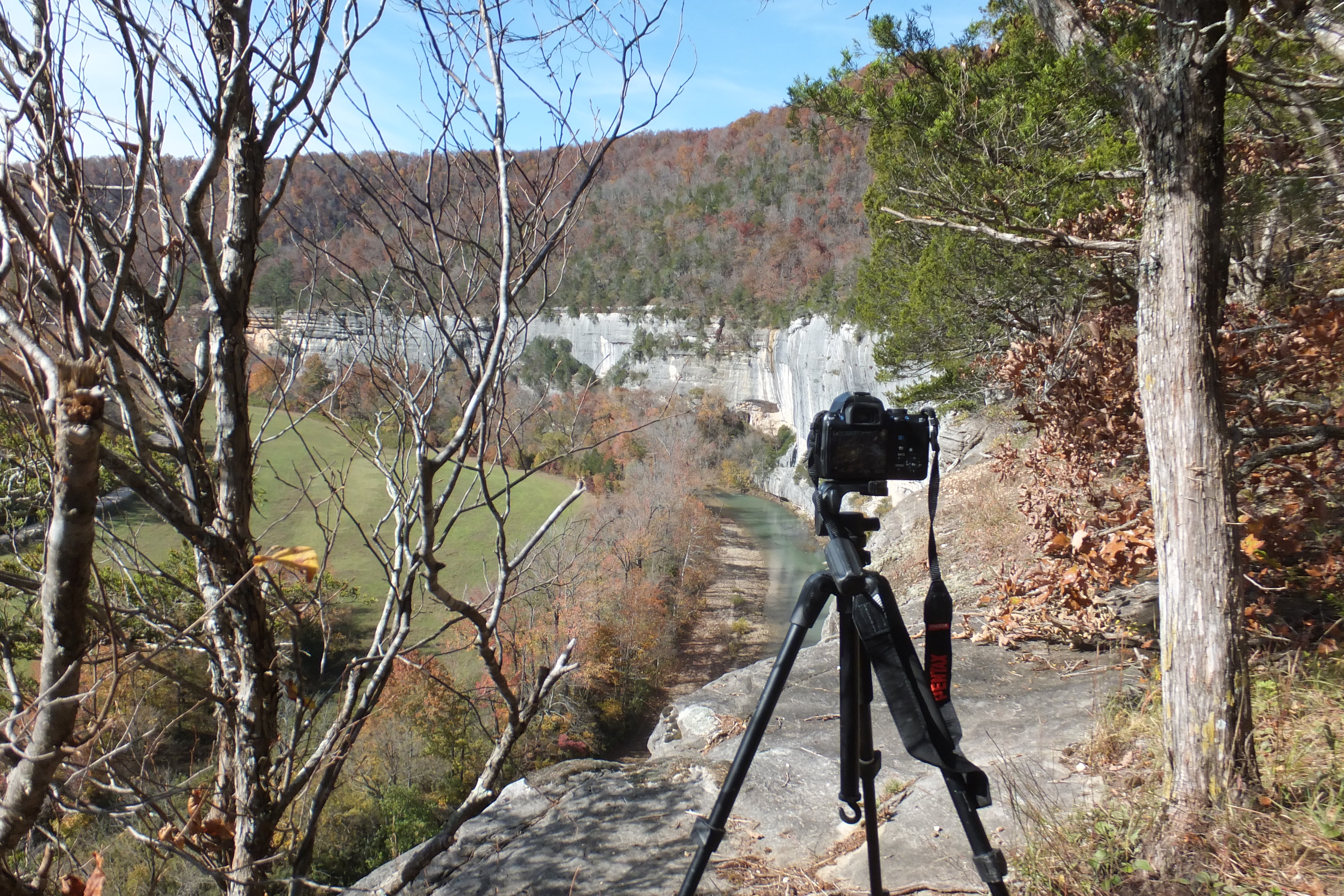
View from Photo Opt "O"
.jpg)
WF "g1" Roark Bluff Pouroff
36.04389°, 93.34432°
Top of Roark Bluff Pouroff
looking south
WF "g2"
36.04442°, 93.34464°
WF "g3"
36.044765°, 93.34504°
WF "g3" (30')
Bee Bluff Photo Opt looking south
(Photo by Anthony Clark)
36.03547°, 93.34467°