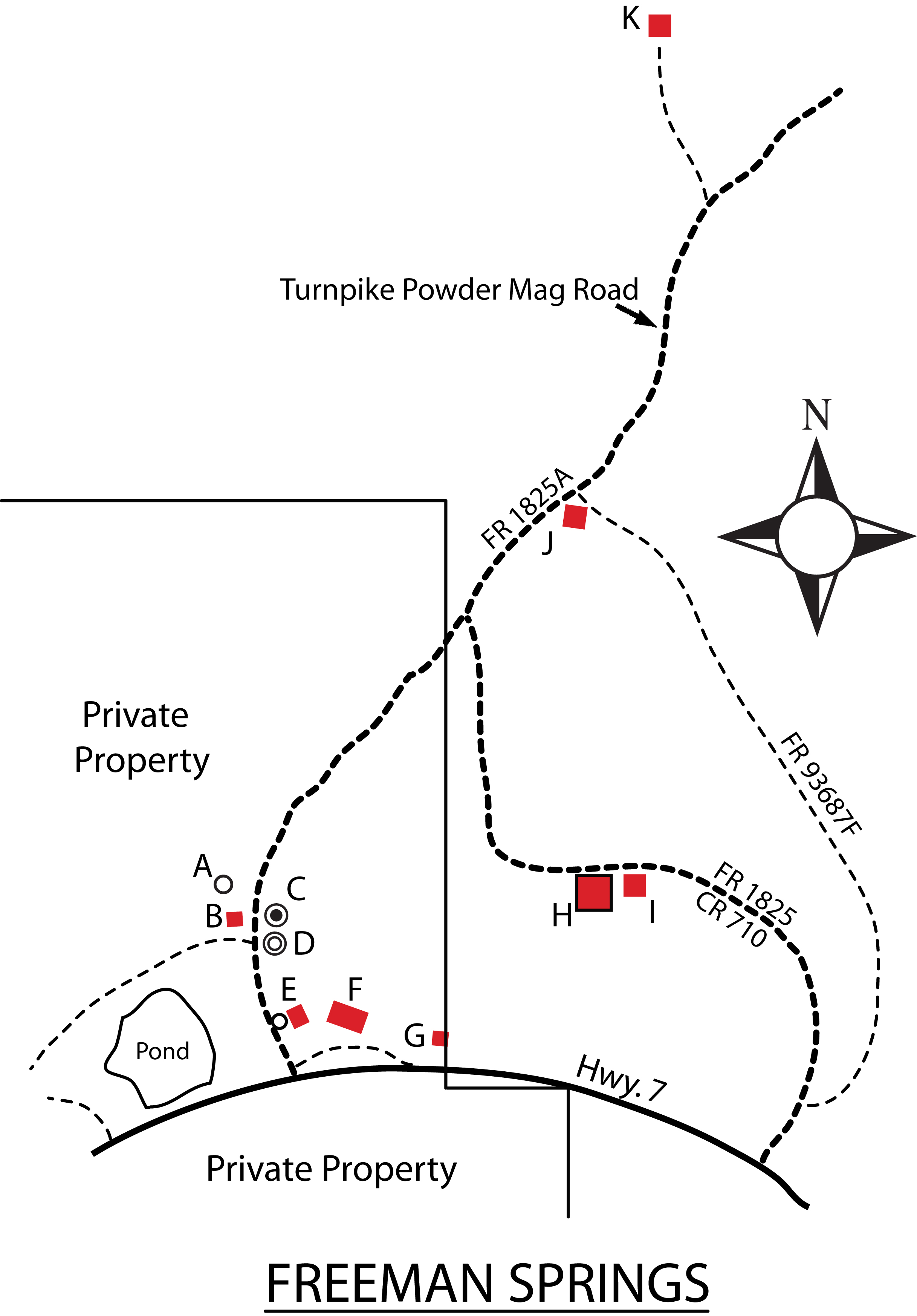
Freeman Springs was named after the first postmaster, Mose W. Freeman
| TAKAHIK River Valley Hikers |
| Home Scheduled Hikes Pictures Videos Membership Links Trails & Waterfalls Mushrooms Products In Memory Of Scholarships |
| FREEMAN SPRINGS |
|
Freeman Springs was named after the first postmaster, Mose W. Freeman |
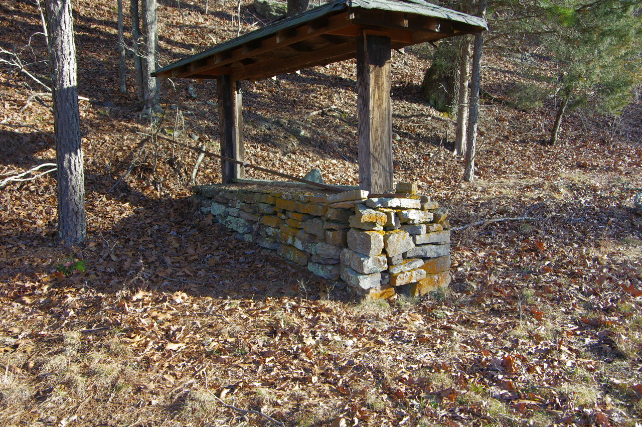
 "A" Dug Well |
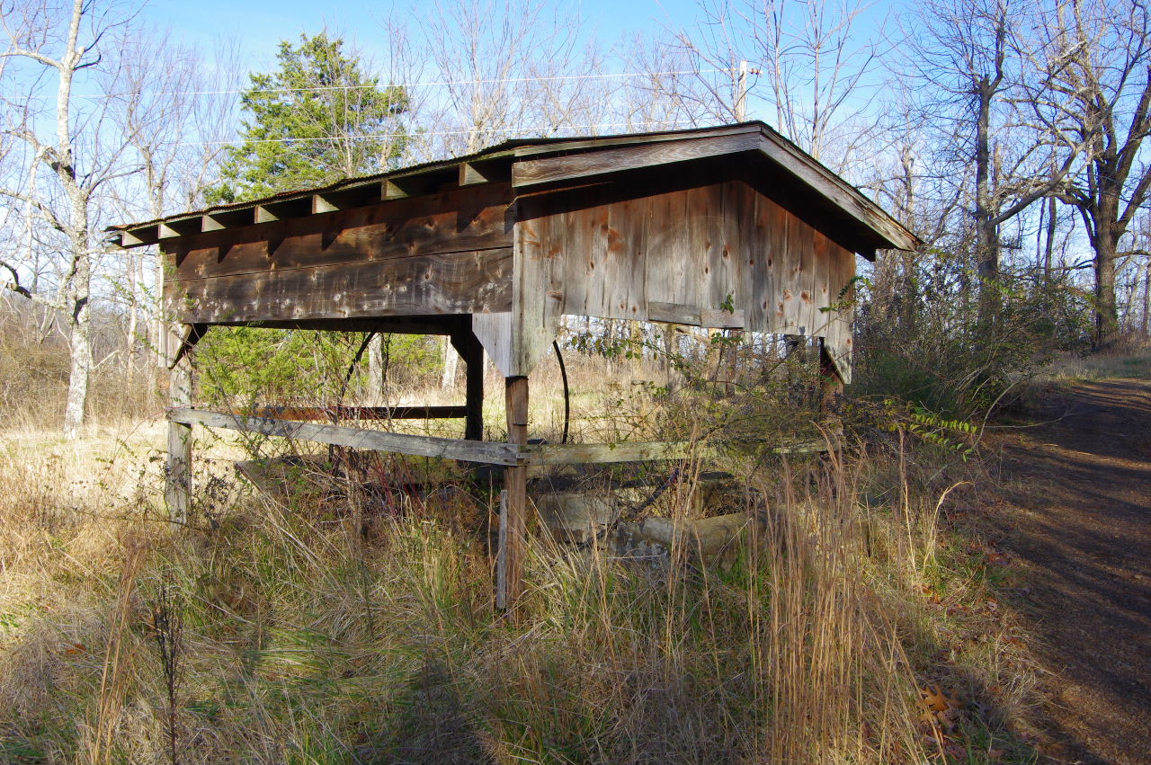 "B" Covered Shed |
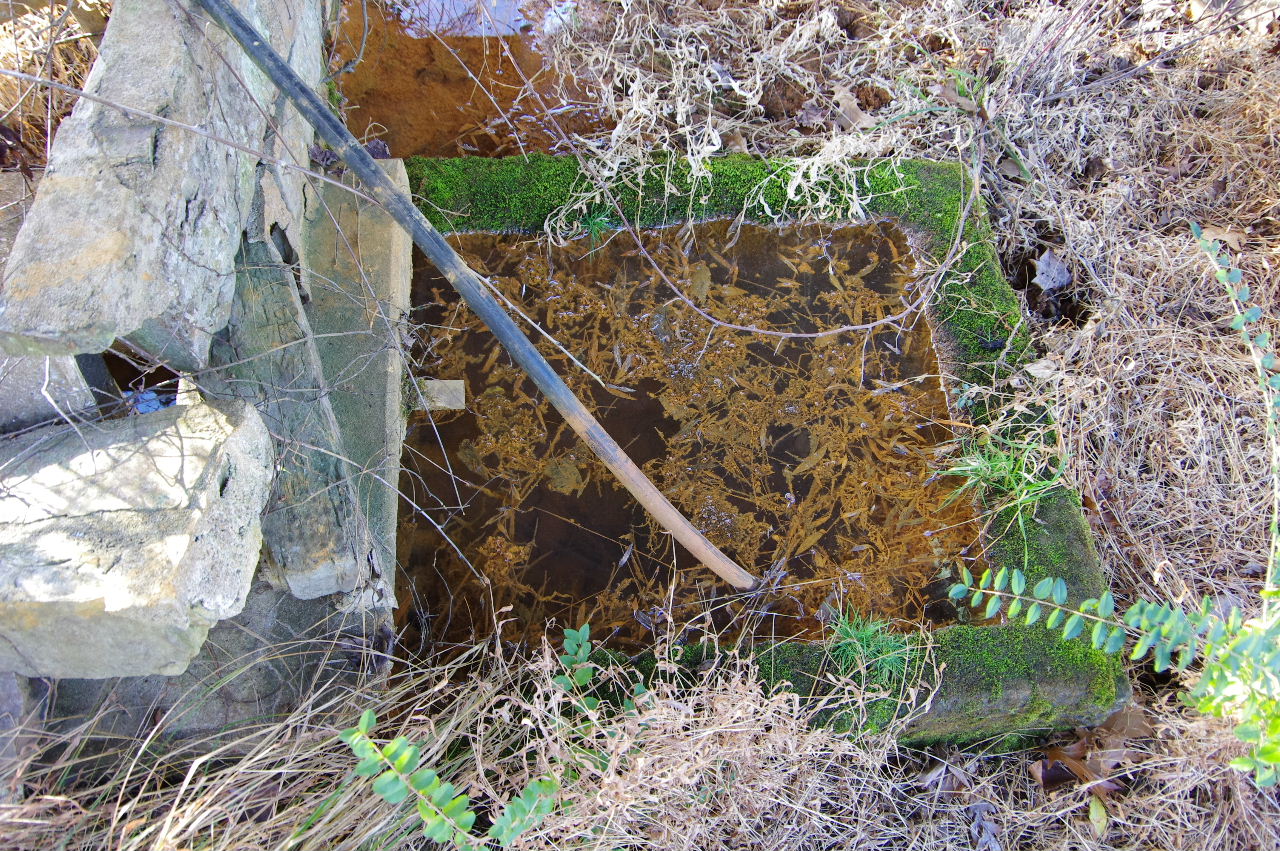 "B" Vat for Spring |
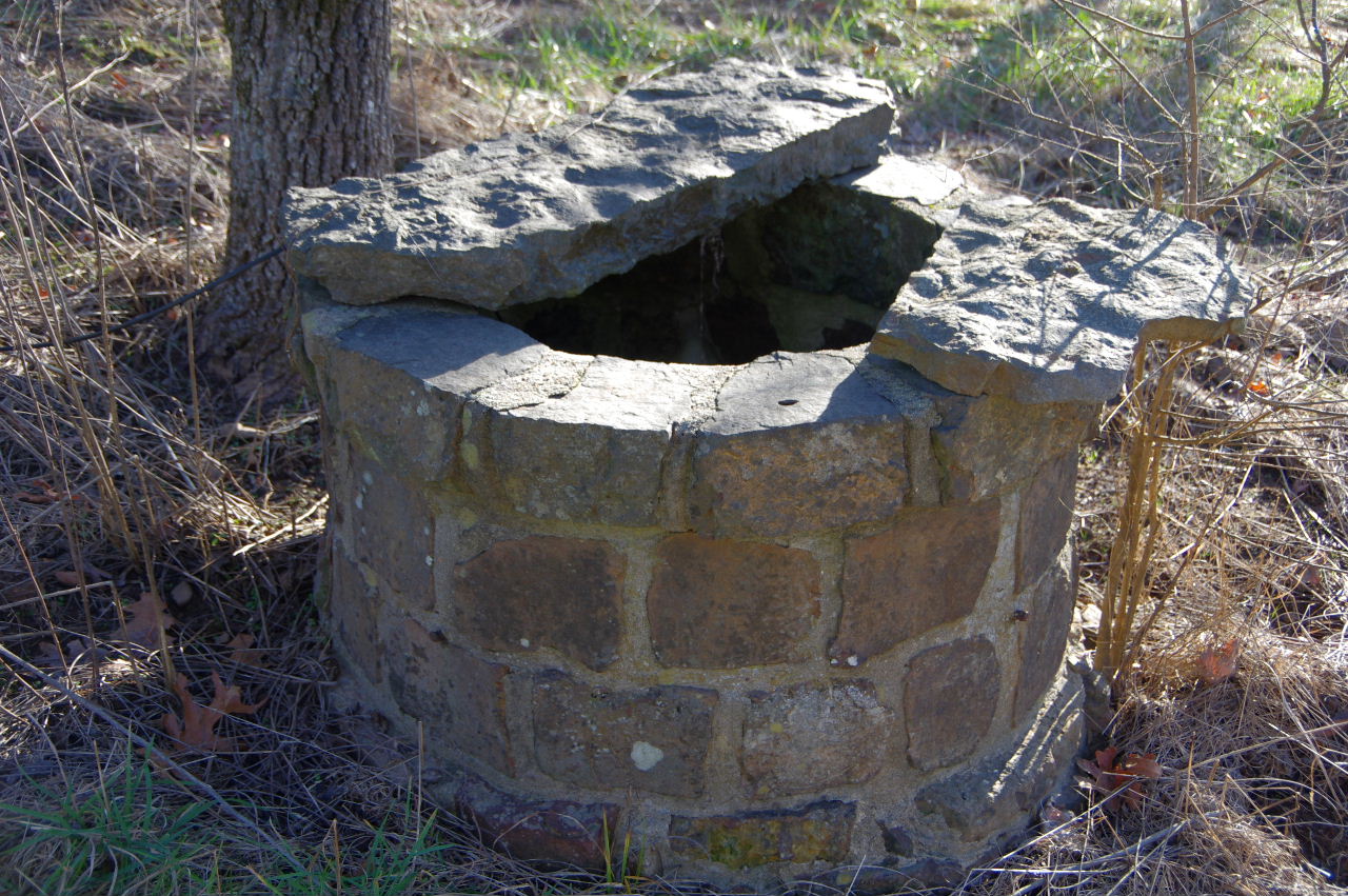
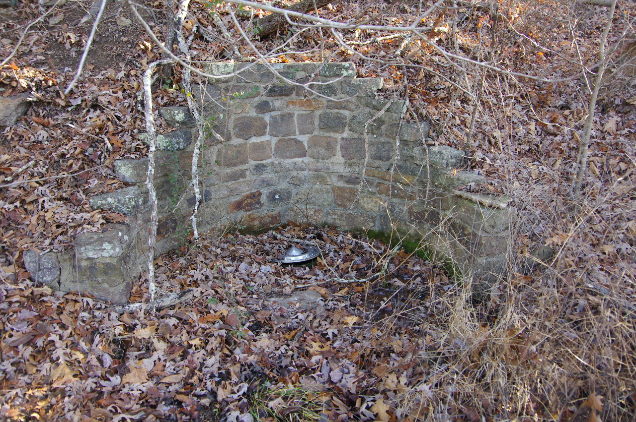 "C" Freeman Spring (Under wheel cover) 35.66253°, 93.07882° |
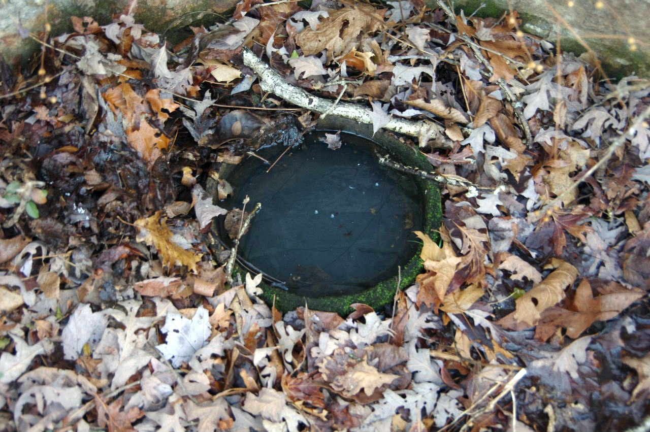 "C" Freeman Spring (Wheel cover removed) There are several other springs coming out of the hillside located in different places. |
 "D' Plaque Rock Wall |
.JPG) "D" Plaque on Rock Wall |
Freeman
Springs 1840-1937 A village with church, school, gen. store, hotel and mineral springs. Located on the Pioneer Trail, once served rest, recreation & supplies to the weary traveler. This relay center played an important part to the early settlers & wagon trains in developing this great county. People still visit here, drink from these springs and tell how their forefathers told it to them. |
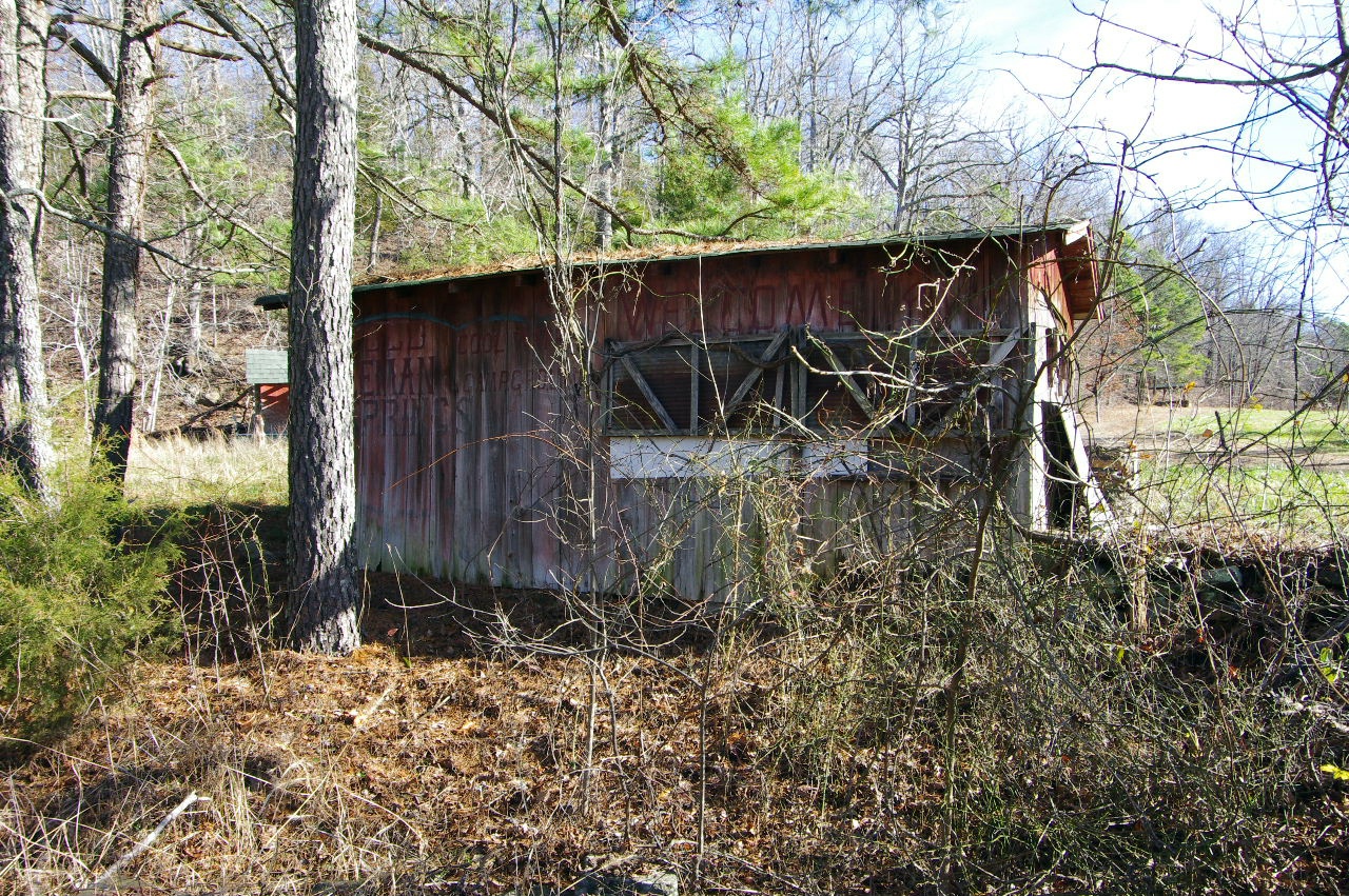 "E" Building |
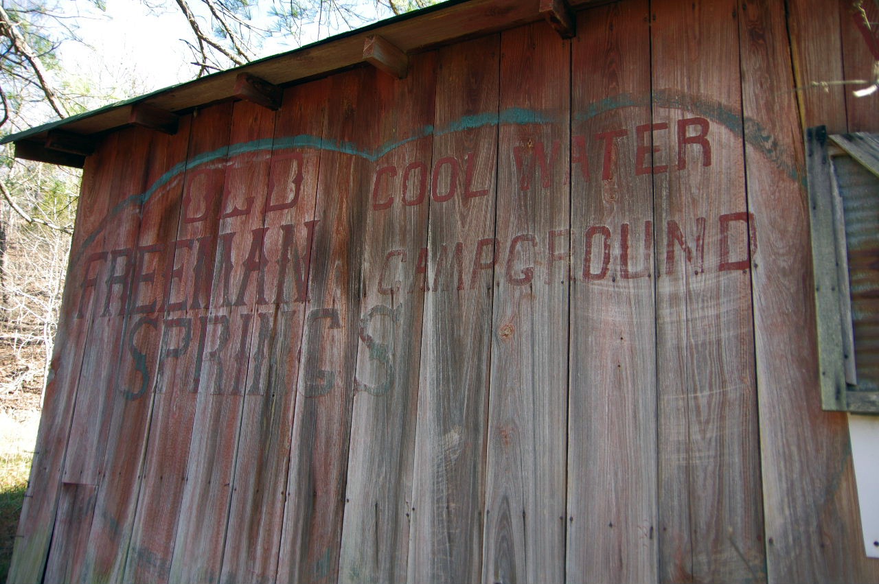 "E" Old Freeman Springs (Cool Water, Campground) |
 "E" Dug Well next to building |
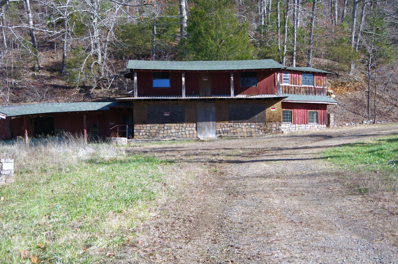 "F" Building (Property presently owned by Amber Sanders) |
 "G" (With pipe coming out of hillside) |
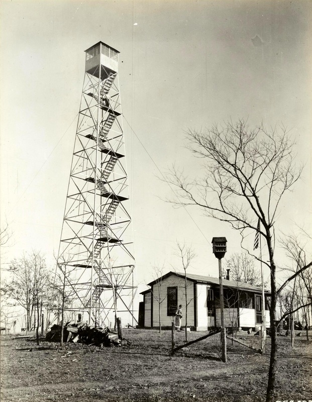 Picture of old Freeman Fire Tower (1931) 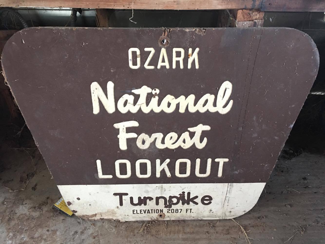 |
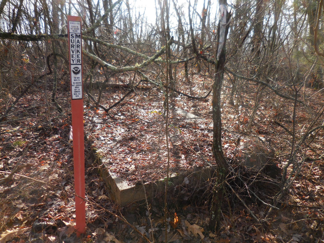 "H" Site of old Freeman Fire Tower 35.66286°, 93.07625° |
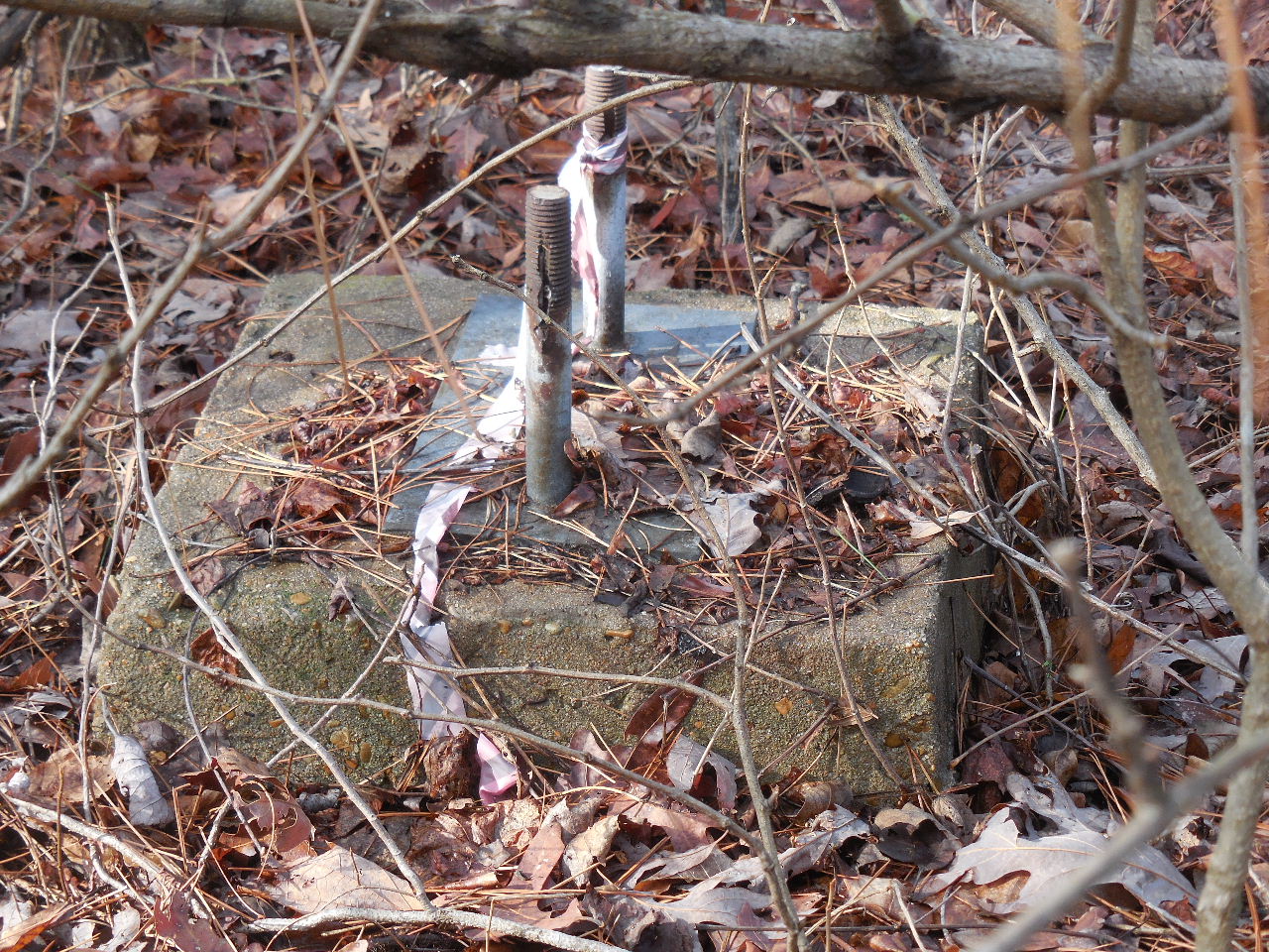 "H" Typical anchor for tower |
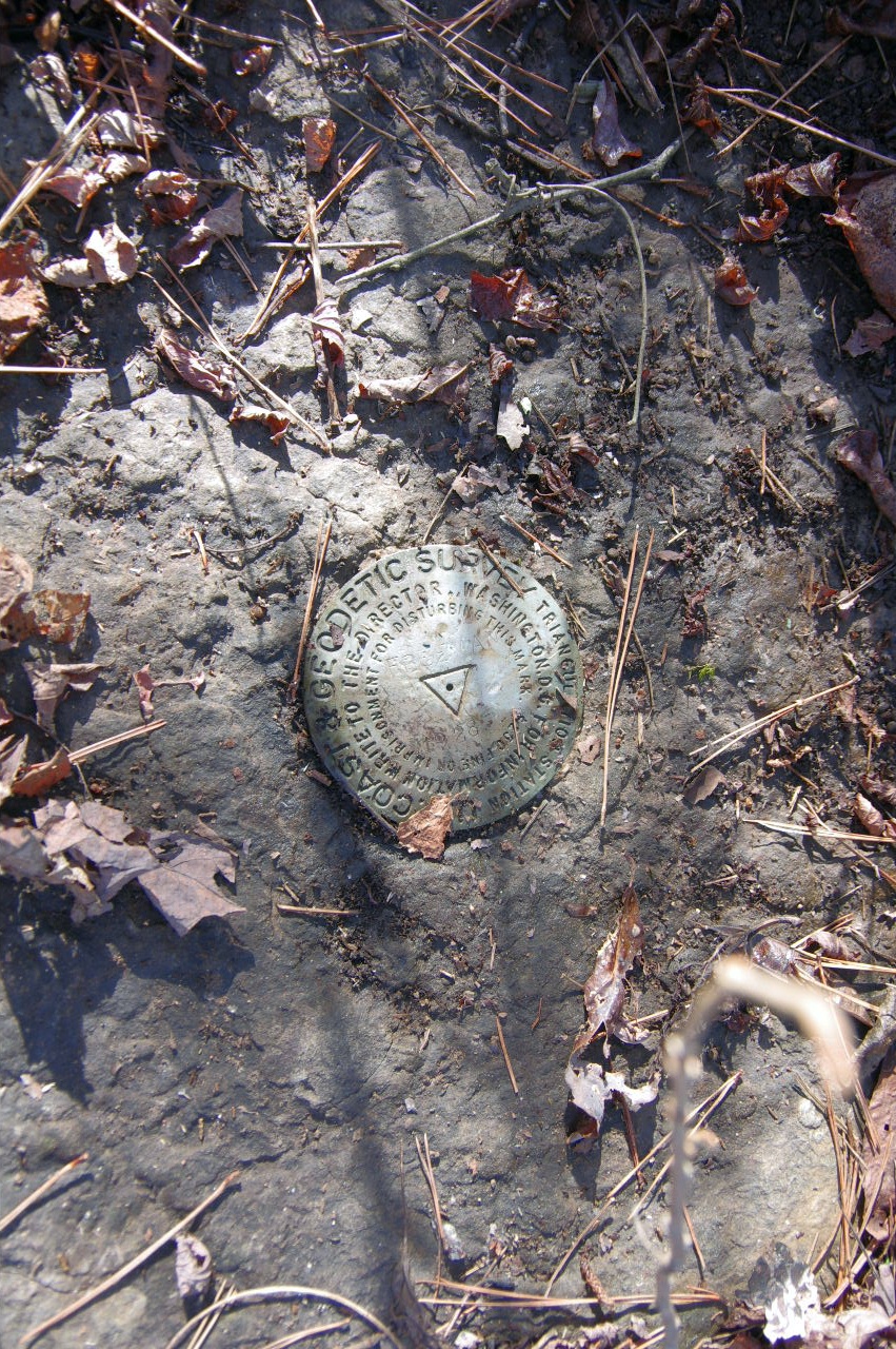 USGS Monument next to Fire Tower site (Freeman 1928, Elevation 2087) |
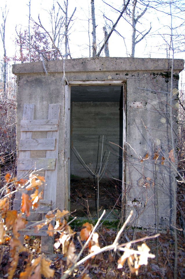
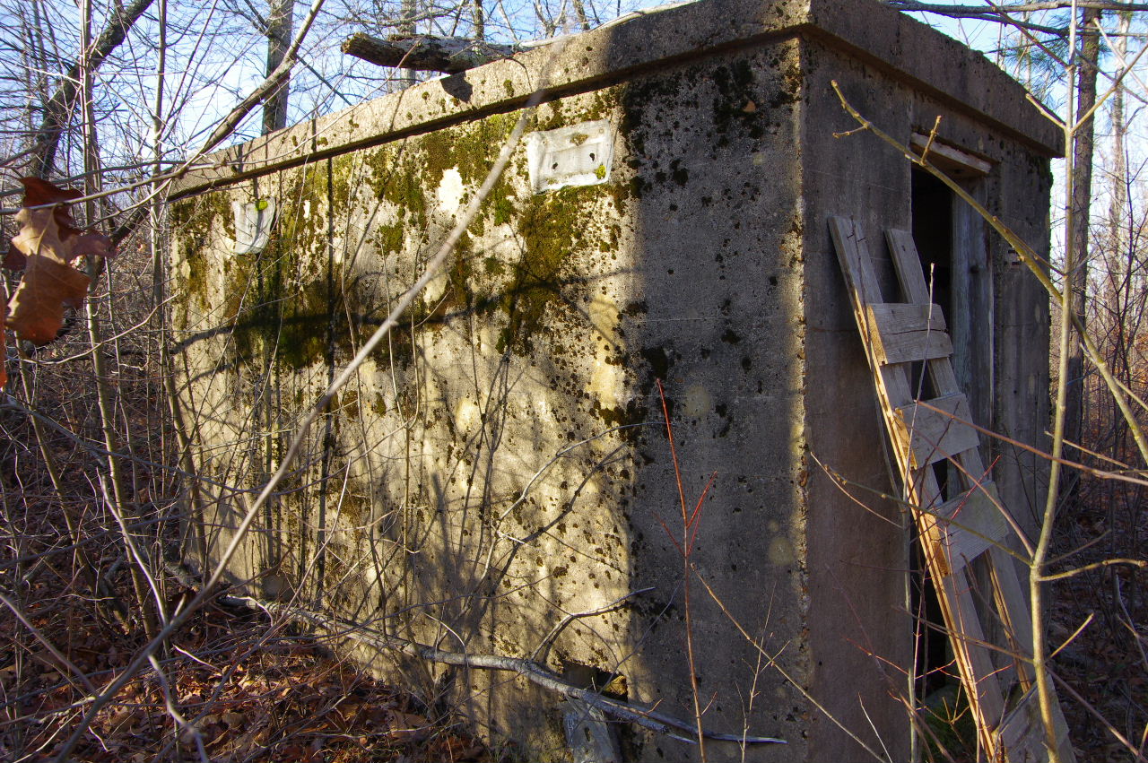
 "I" Underground Rock Cellar (?) 35.66286°, 93.07604° |
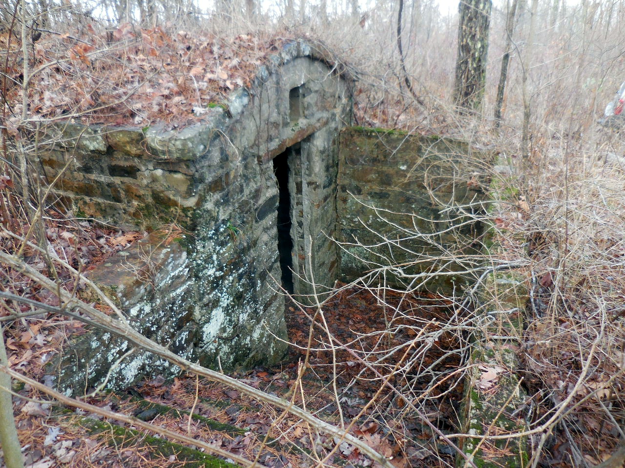 "I" Entrance |
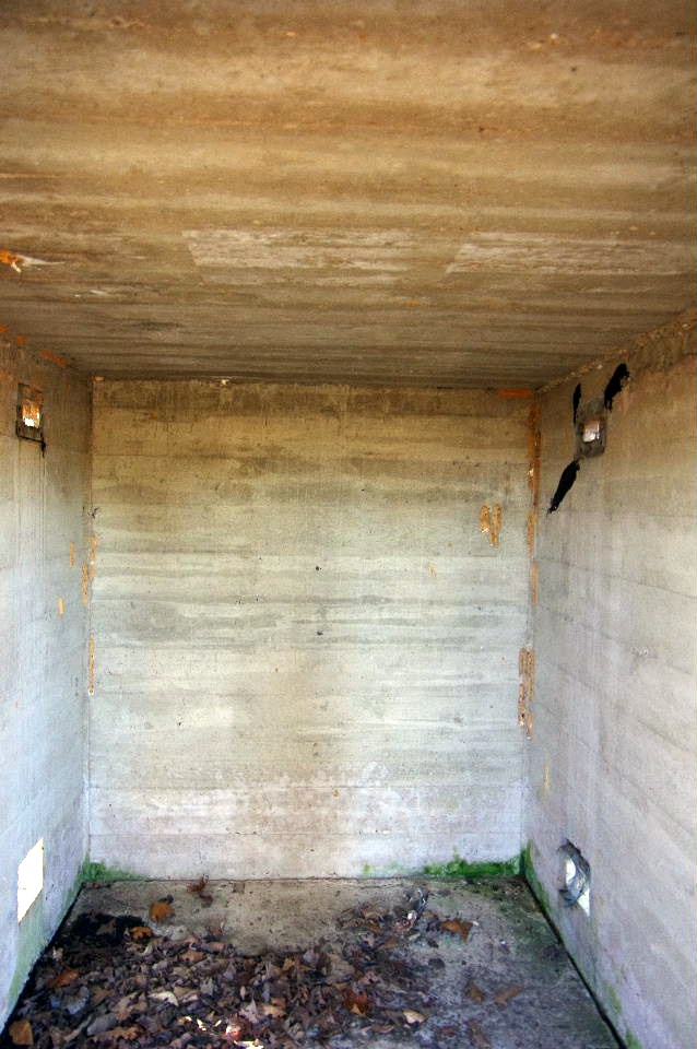
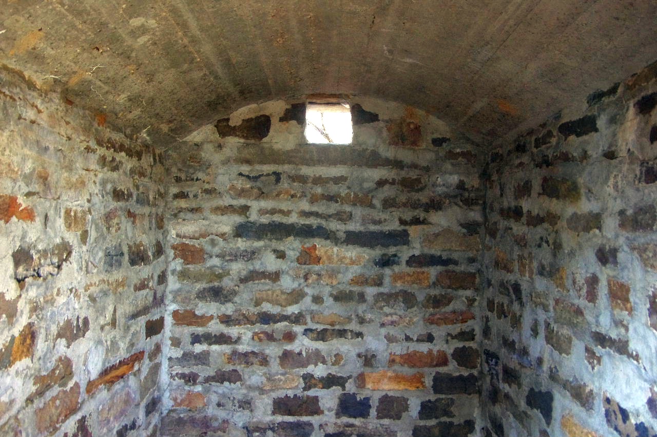 "I" Inside |
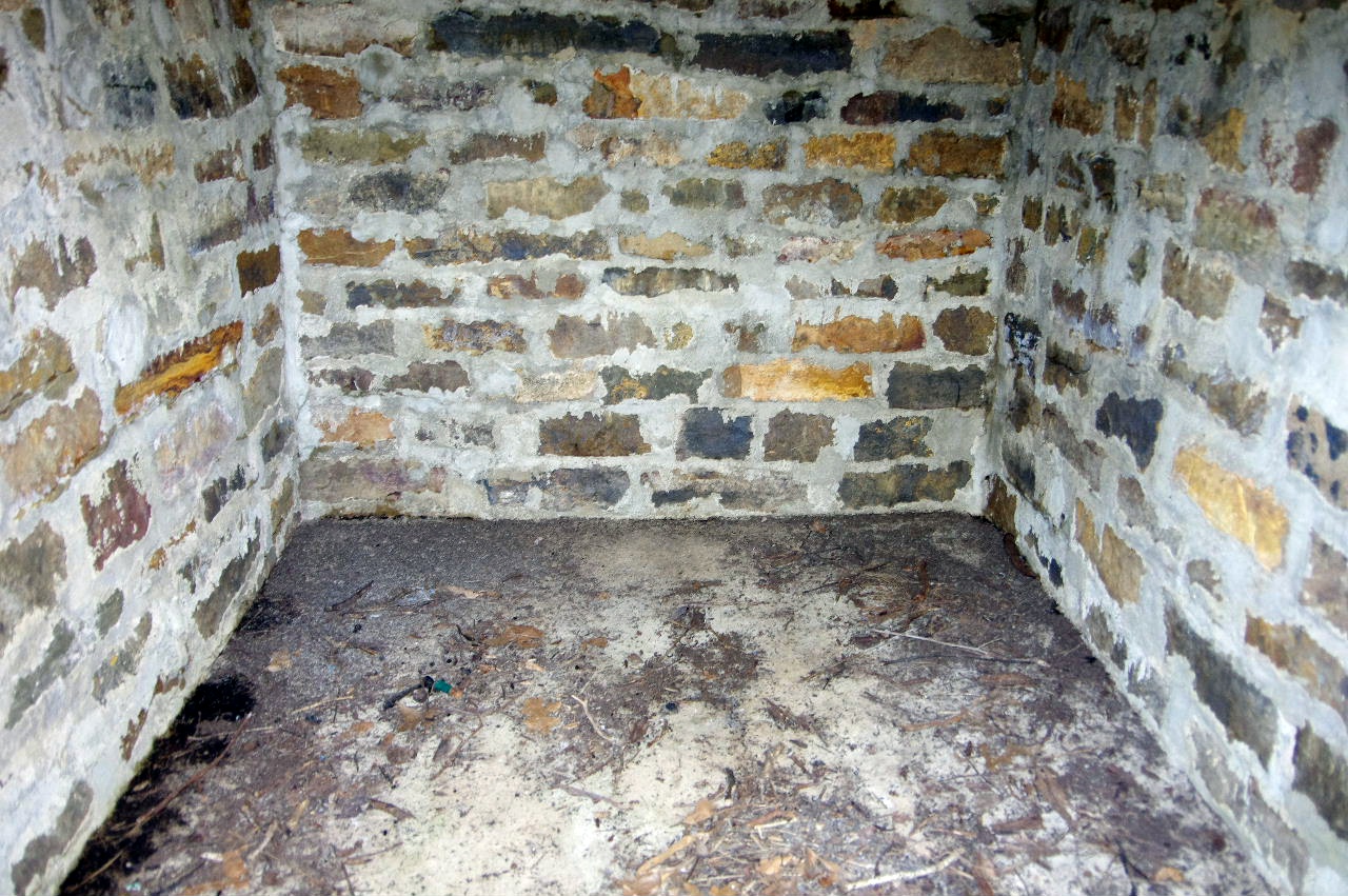 "I" Inside |
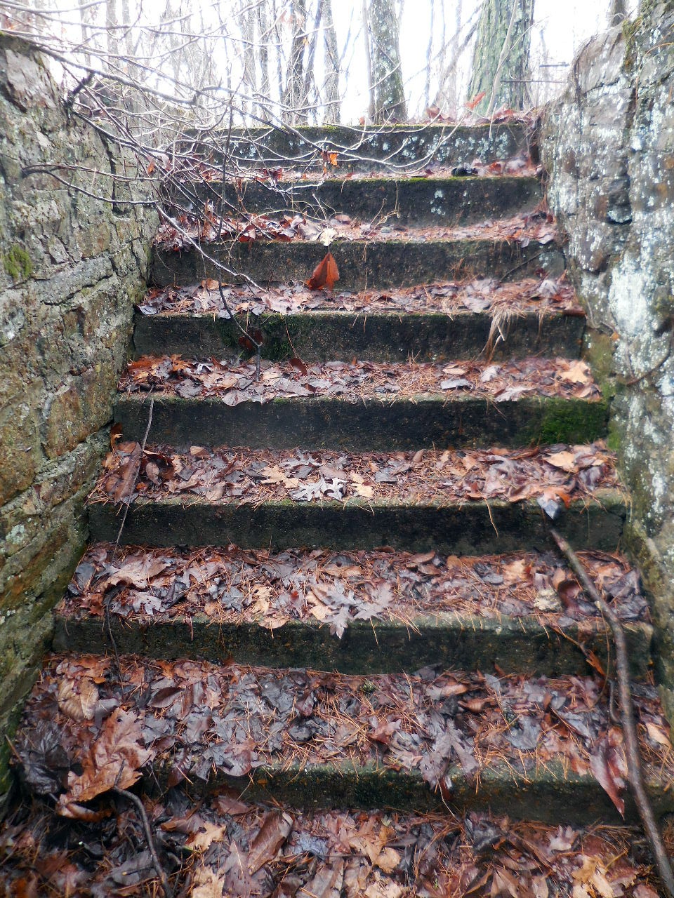 "I" Steps |
 "I" Opening above doorway |
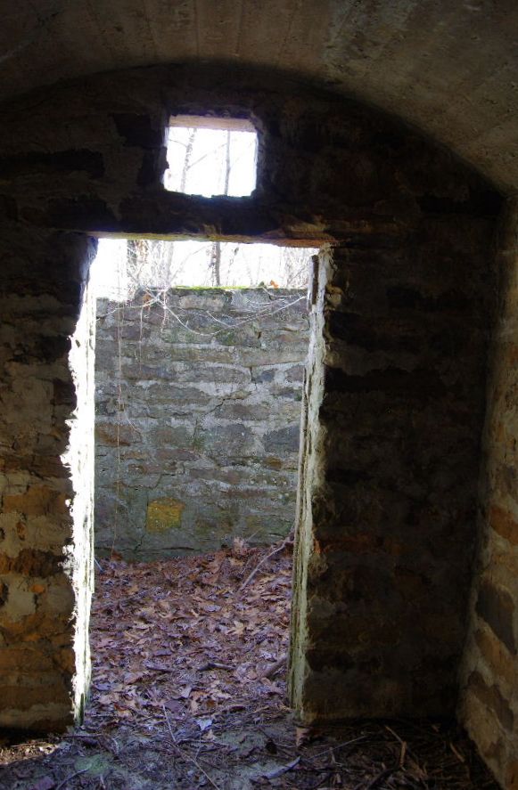 "I" Inside looking out |
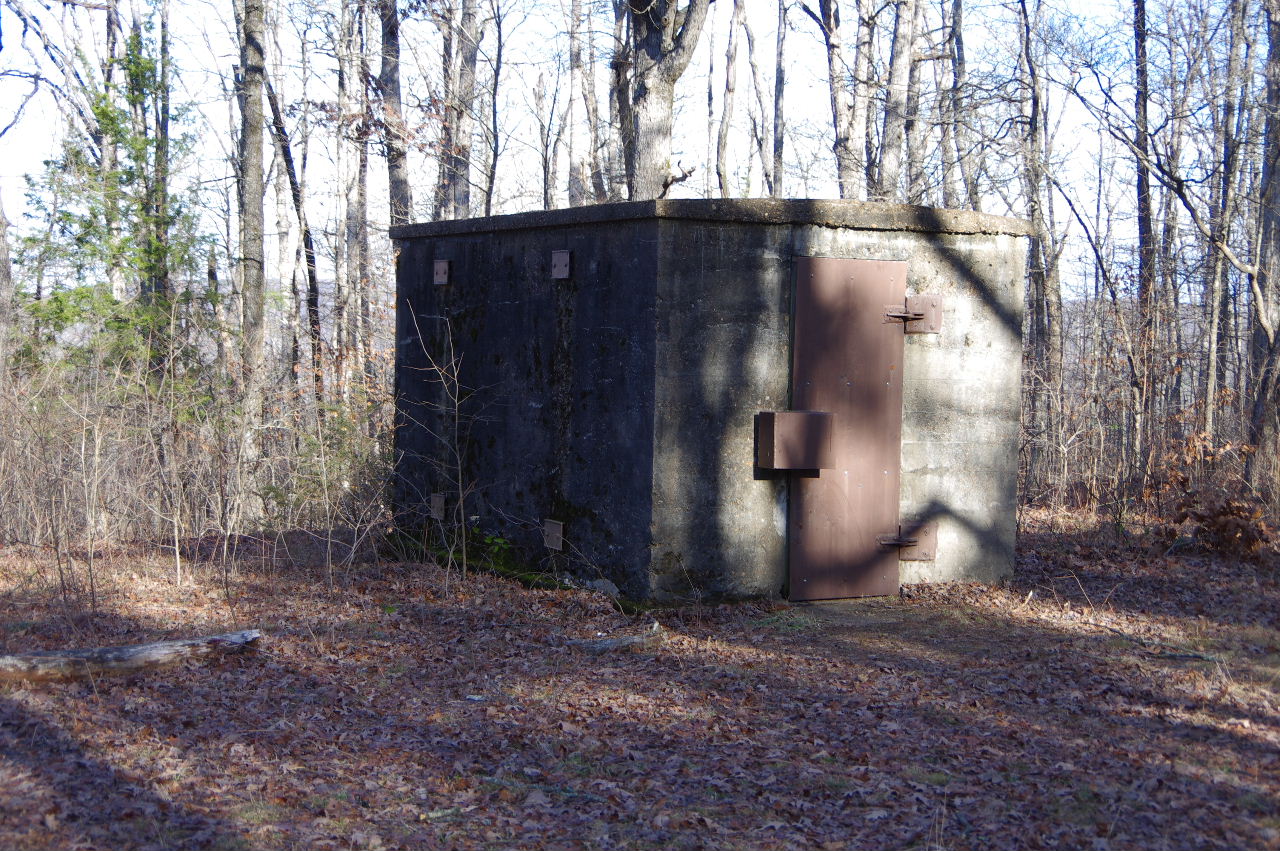
 "J" Front View |
 "J" Storage Bldg. for Explosives 35.66512°, 93.07634° (Used by the nearby CCC Camps) |
 "J" Inside View |
 "K" Storage Bldg. for Explosives 35.66800°, 93.07579° |
 "K" Inside View |
 "K" "Place Explosives 5" from Wall" |